Suggested Searches

1 min read

Snow in Southern Central United States

Instruments:
Topics:
2009-12-25 00:00:00
December 25, 2009

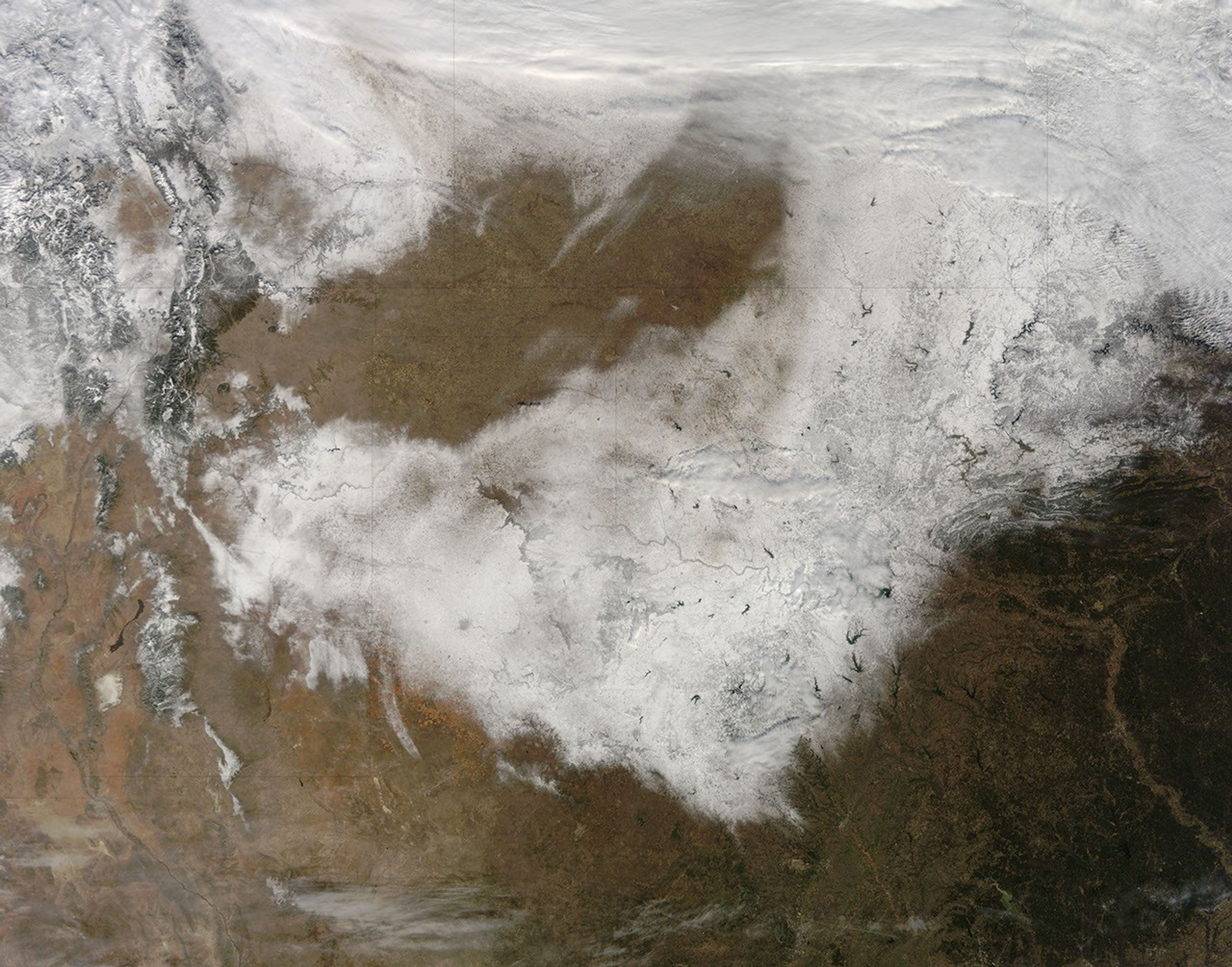
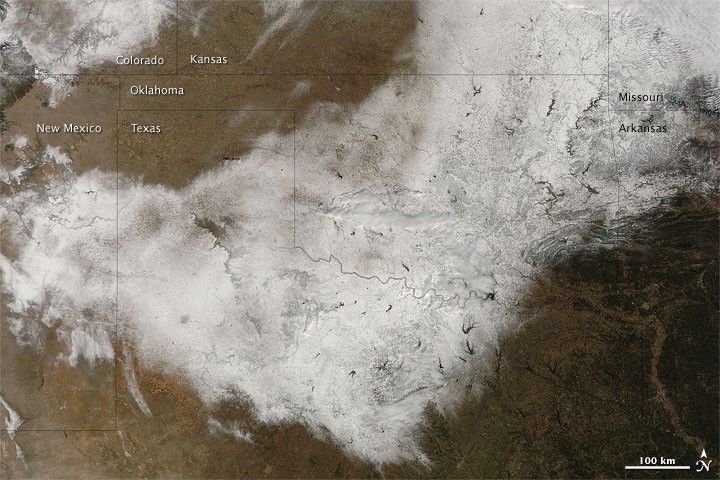
Snow cover sprawled across the southern central United States on December 25, 2009. The Moderate Resolution Imaging Spectroradiometer (MODIS) on NASA’s Terra satellite captured this true-color image the same day. Shaped vaguely like a giant boomerang, snow cover stretches from New Mexico across northern Texas and into eastern Oklahoma, Kansas, Missouri, and Arkansas. Snow cover also fills southeastern Colorado. Areas not covered with snow appear brown in this wintertime image.

References & Resources

NASA image by Jeff Schmaltz, MODIS Rapid Response Team, Goddard Space Flight Center. Caption by Michon Scott, NASA Earth Observatory.

You may also be interested in:

Stay up-to-date with the latest content from NASA as we explore the universe and discover more about our home planet.

The West Faces Snow Drought
4 min read

Very wet—but very warm—weather in the western U.S. has left many mountainous regions looking at substantial snowpack deficits.

Article
Snow Buries the U.S. Interior and East
2 min read

Satellites observed a frozen landscape across much of the country after a massive winter storm.

Article
Winter Grips Japan
3 min read

The country's northern regions are accustomed to snow, but unrelenting storms have snarled transportation and caused other challenges this winter.

Article