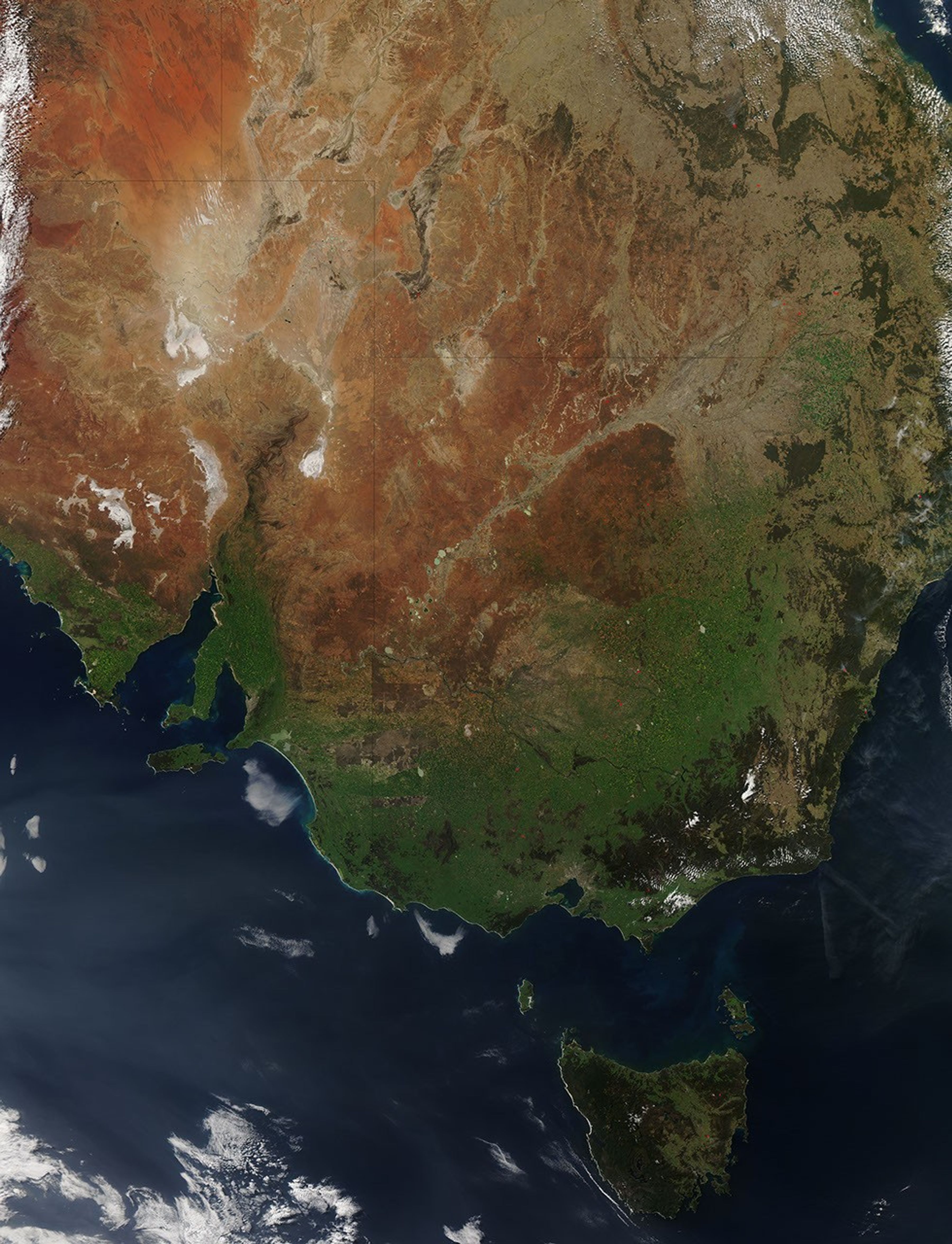
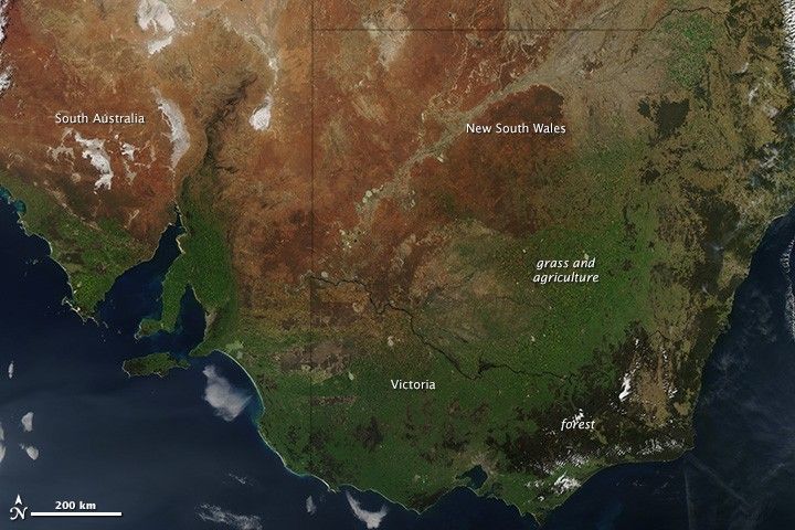
The blush of spring colored southeastern Australia green on September 2, 2013, when the Moderate Resolution Imaging Spectroradiometer (MODIS) on NASA’s Aqua satellite acquired this natural color image. The southern continent was just coming out of its winter rainy season—September 1 marked the first day of spring—and the dark green tones show that the rains produced ample plant growth.
All of that green could be bad news during the summer fire season, however. The Bushfire Cooperative Research Center and Australasian Fire and Emergency Service Authorities Council forecast an active fire season for parts of Australia in 2013-2014, including much of the area shown here. Australia defines fire potential as the chance that a fire will require more resources to control than a local area has at its disposal. The potential for fire depends on many factors, including fuel load, rainfall, and temperature.
In the grasslands of New South Wales and South Australia, abundant winter rains spurred plant growth. These areas are pale to bright green in the image. Several seasons of above-average rain have resulted in a heavy fuel load. Once the grasses dry during the summer, there will be plenty of material to fuel large fires.
The dark green forests along the coast of New South Wales and Victoria have the opposite problem: Below average rain and warm winter temperatures have left the forests dry. The dry, warm winter followed Australia’s hottest summer on record. The summer heatwave stressed the forests to such an extreme that even those areas that received average rainfall were still dry and prone to fire.
References & Resources
- Australian Broadcasting Corporation News (2013, September 2) Large areas of southern Australia at higher risk of bushfires this summer. Accessed September 9, 2013.
- Australian Broadcasting Corporation Rural (2013, September 2) Inland grass growth increases bushfire risk. Accessed September 9, 2013.
- Bushfire Cooperative Research Center and Australasian Fire and Emergency Service Authorities Council (2013, September) Southern Australia seasonal bushfire outlook 2013-14. Accessed September 9, 2013.
NASA image courtesy Jeff Schmaltz, LANCE/EOSDIS MODIS Rapid Response Team at NASA GSFC. Caption by Holli Riebeek.