GOES Animations:
small (475 KB)
medium (1 MB)
large (13 MB)
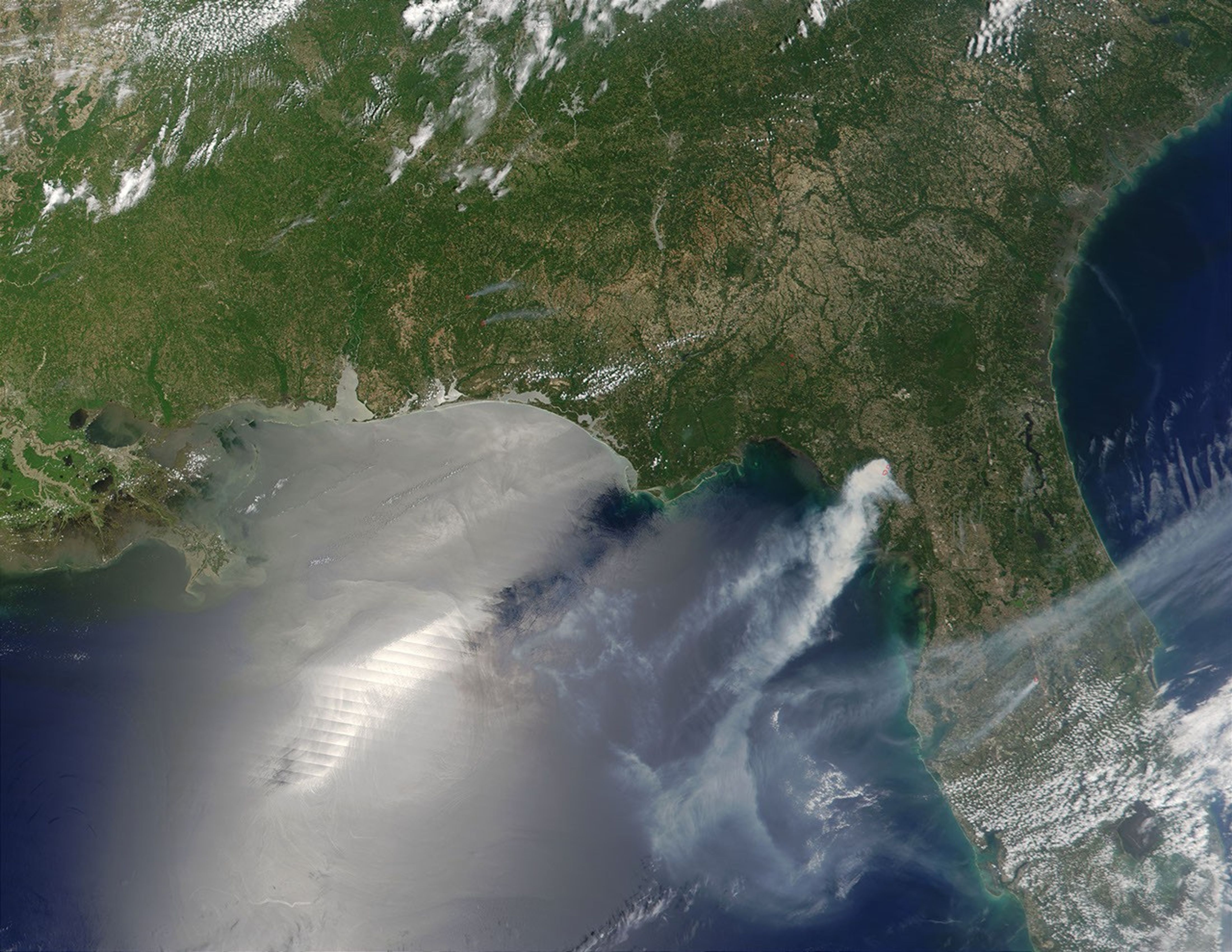
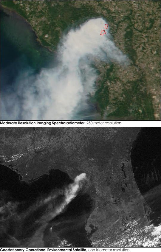
The Steinhatchee fire in northern Florida had burned more than 54,000acres by the end of Thursday, May 24, 2001. The images above show viewsof the fire from two different satellite sensors: the Moderate-resolutionImaging Spectroradiometer (MODIS) and the Geostationary Operational EnvironmentalSatellite (GOES) imager. Both instruments viewed the fire at roughly 10:45 a.m.Eastern Daylight Savings Time, May 24, 2001.
The top image shows true-color data from MODIS, with active firesoutlined in red. Designed for global climate studies, MODIS circles the Earth from pole to pole, viewing the entire planet every one to two days. MODIS collects data in 36 spectral bands, ranging from blue to thermal infrared. Applications of the data include fire and land surface change monitoring, aerosol and cloud research, and ocean studies. Launched aboardNASA's Terra satellite in 1999, MODIS is expected to operate at least through 2005, with subsequent sensorson follow-on missions to continue similar global observations for at least another 10 years after that.
The GOES satellites, on the other hand, continually monitor weather over theWestern Hemisphere. Current GOES satellites acquire data in five visible and infrared bands. GOES-East acquired this image while stationed above Ecuador. Geostationary satellites complete one orbit of the Earth around the equator eachday, so they continually view the same area. In fact, GOES-East acquires images ofFlorida every 15 to 30 minutes, as shown by ananimationof the fire. Notice how the smoke, at high altitudes, is moving to the west (left) whilemany of the clouds, at lower altitudes, move to the east.
References & Resources
MODIS image courtesy Jacques Descloitres, MODIS Land Rapid Response Team. GOES animation by Robert Simmon, based on data from the GOES project science office.