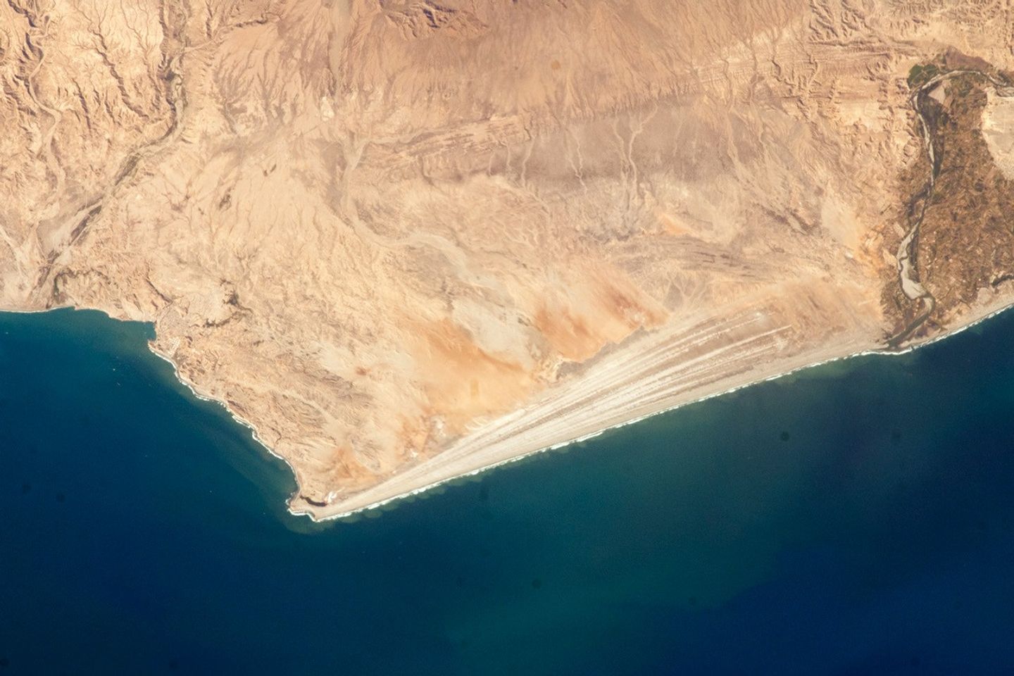
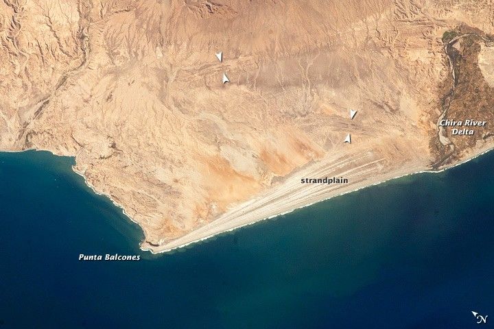
The scale and orientation of landscape features that are difficult to see from the ground often become readily visible from orbit. Numerous subparallel lines along the arid, northern coast of Peru are close-packed beach ridges, known collectively as a strandplain. (For scale, the strandplain is 30 kilometers long.) Each ridge shows the position of a prior shoreline. The Chira River delta appears at image right, with dark green agricultural fields occupying the area. A smaller river reaches the sea, without forming a delta, at image left. The prominent cape at lower left is Punta Balcones, a region with many oil wells.
Strandplains are built by successive additions of beach sand, usually from some nearby source. Currents on this coast of South America (about 5 degrees south of the Equator) come from the south, suggesting that the Chira River delta is the source of the sand. The newest beach is being formed today by the waves—which appear as the thin, ragged white line along the strandplain—supplied by the north-flowing current. The regularity of the spacing of the beaches suggests that some episodic influx of sediment controls beach formation. This influx may be determined by floods coming down the Chira River, possibly driven by the heavy rains of El Nino events, which occur irregularly every few years.
Two other sets of faint parallel lines can be seen on higher ground inland (marked with arrows), with the upper set stretching all the way from the Chira river floodplain. Observed in many places along the coast of Peru, these also may be strandplains generated when the land surface was at a lower elevation. Both also may have been produced by sand from the Chira River. The land surface is known to be rising along this coast with the rise of the Andes Mountains, which explains why the upper shorelines now lie 120 meters above sea level.
References & Resources
Astronaut photograph ISS032-E-16579 was acquired on August 11, 2012, with a Nikon D2Xs digital camera using a 180 mm lens, and is provided by the ISS Crew Earth Observations experiment and Image Science & Analysis Laboratory, Johnson Space Center. The image was taken by the Expedition 32 crew. It has been cropped and enhanced to improve contrast, and lens artifacts have been removed. The International Space Station Program supports the laboratory as part of the ISS National Lab to help astronauts take pictures of Earth that will be of the greatest value to scientists and the public, and to make those images freely available on the Internet. Additional images taken by astronauts and cosmonauts can be viewed at the NASA/JSC Gateway to Astronaut Photography of Earth. Caption by M. Justin Wilkinson, Jacobs/ESCG at NASA-JSC.