


browse image for orbit 3626
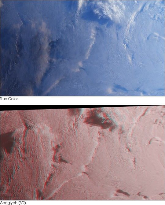
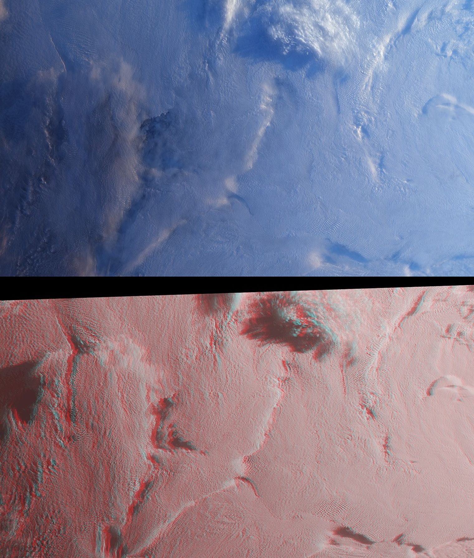
Stratus clouds are common in the Arctic during the summer months, andare important modulators of the arctic climate. This image pair from theMulti-angle Imaging SpectroRadiometer (MISR) was acquired on August 23,2000, and shows a region of stratified clouds situated near the boundaryof the permanent polar ice pack to the north of the Chukchi and EastSiberian Seas. At top is a natural-color view captured by MISR’svertical-viewing (nadir) camera. At bottom, a stereo anaglyph enablesobservation of multiple cloud layers.
The images are centered at about 75 degrees north latitude, near theinternational dateline. These high-latitude data were acquired duringthe “ascending node” of the Terra orbit, that is, the portion of theorbit where the spacecraft is flying from south to north. The imageshave been rotated 90 degrees counterclockwise to facilitate stereoviewing, thereby orienting them with south toward the left and northtoward the right. Solar illumination is very oblique, and sunlight iscoming from the right-hand side of the images. Viewing the anaglyph in3D requires the use of red-blue glasses, with the red filter placed overyour left eye. Information on ordering glasses can be found at:http://photojournal.jpl.nasa.gov/Help/VendorList.html#Glasses
Dark ocean waters and ice floes can be observed through severaltranslucent clouds in the left-hand portion of the nadir image. Theseclouds are no longer translucent in the anaglyph image, which wascreated using data from MISR’s two most obliquely forward-viewingcameras. The cold, stable air causes the clouds to persist in stratifiedlayers, and this layering is evident in the stereo view. Near the topcenter, a high-altitude cloud formation is illuminated by the Sun andcasts long shadows on the underlying cloud deck.
The Multi-angle Imaging SpectroRadiometer observes the daylit Earthcontinuously and every 9 days views the entire globe between 82 degreesnorth and 82 degrees south latitude. The MISR Browse Image Viewer provides access tolow-resolution true-color versions of these images. These images were generated from aportion of the imagery acquired during Terra orbit 3626. The data havebeen resampled to a resolution of 350 meters per pixel, and cover anarea of about 533 kilometers x 626 kilometers. They utilize data fromblocks 8 to 12 within World Reference System-2 path 176.
References & Resources
Image courtesy NASA/GSFC/LaRC/JPL, MISR Team. Text by Clare Averill (Acro Service Corporation/Jet Propulsion Laboratory), and David J. Diner (Jet Propulsion Laboratory).


