


May 22, 2008
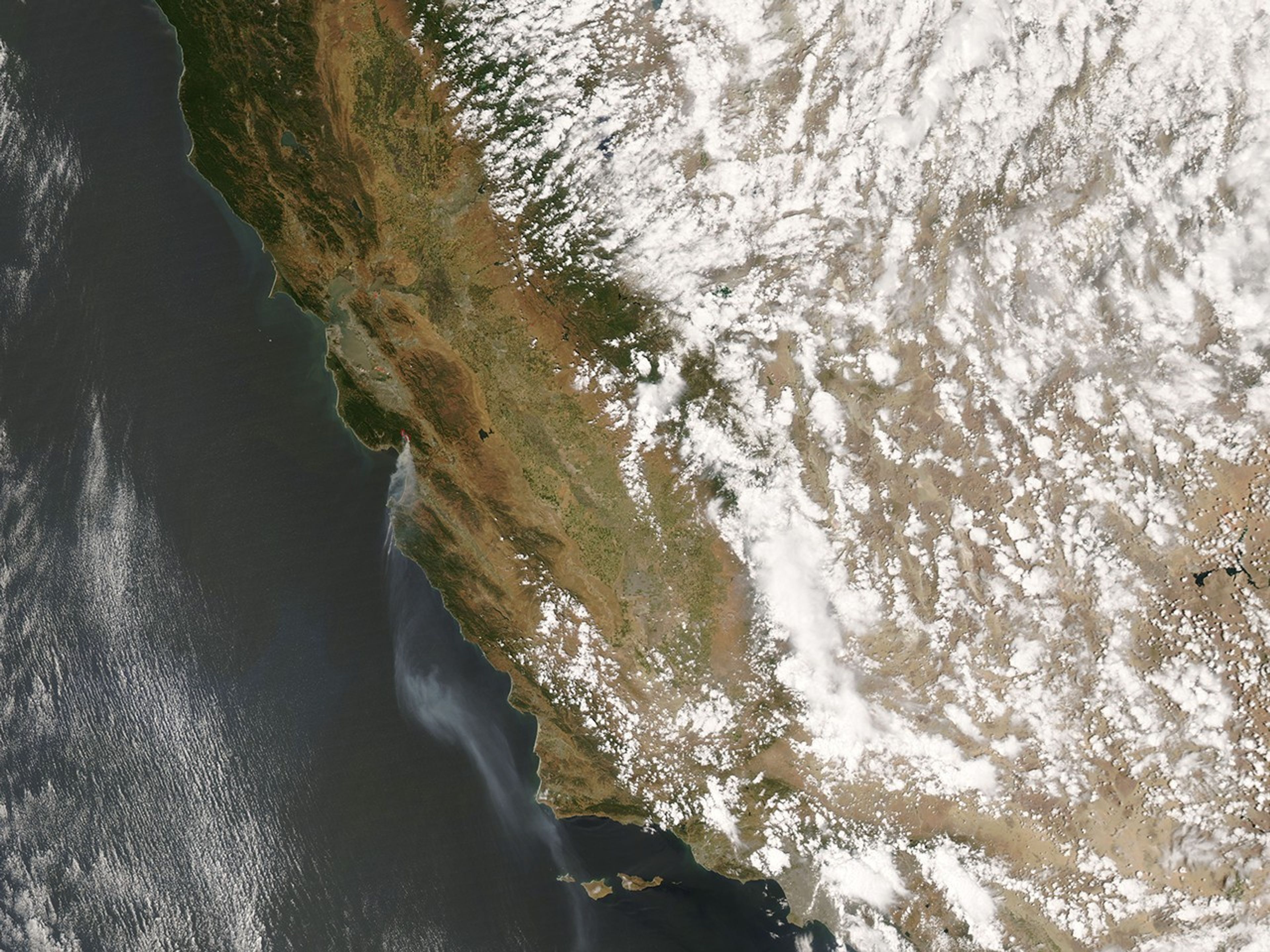
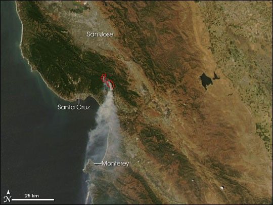
Road closures and evacuations were in effect in the Santa Cruz Mountains south of San Jose, California, on May 23, 2008, because of a wildfire that had burned about 3,000 acres. The Summit Fire was threatening small towns in the region, and was about 15 percent contained according to the May 23 report from the National Interagency Fire Center. This image of the fire (outlined in red) was captured by the Moderate Resolution Imaging Spectroradiometer (MODIS) on NASA’s Aqua satellite on May 22, 2008. A strong wind was spreading smoke southward over Monterey.
References & Resources
NASA image courtesy the MODIS Rapid Response Team. Caption by Rebecca Lindsey.