


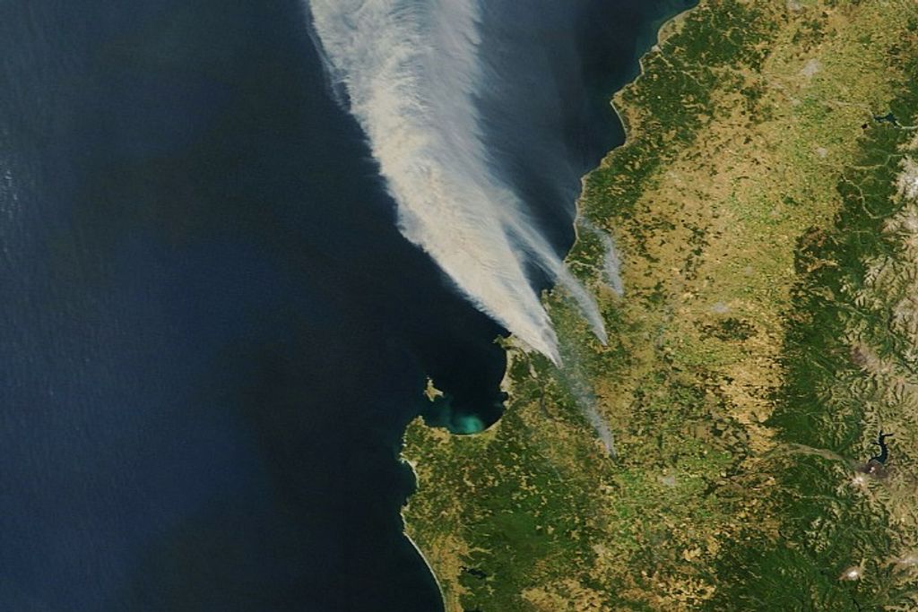


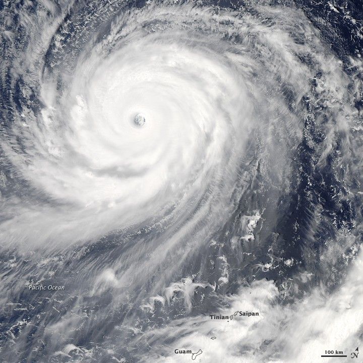
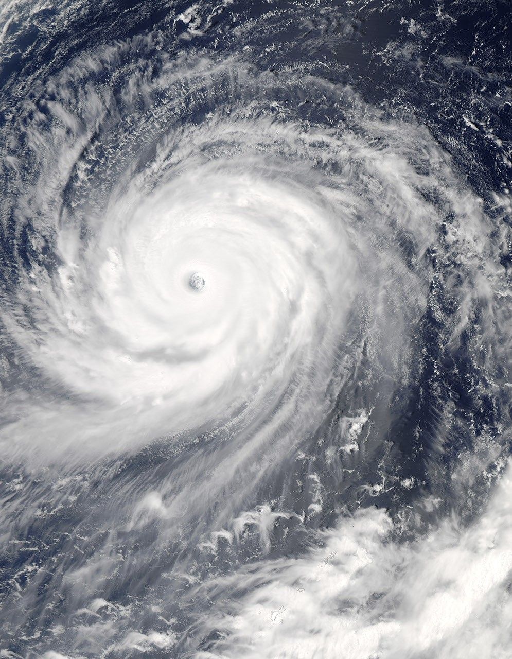
Though Super Typhoon Choi-wan was gradually weakening, it maintained its tight circular shape and well-defined eye on September 17, 2009, when the Moderate Resolution Imaging Spectroradiometer (MODIS) on NASA’s Aqua satellite captured this true-color image. The storm was tracking northeast over the Pacific Ocean, well away from land. The image was acquired at 1:40 p.m. local time, when Choi-wan had sustained winds between 250 kilometers per hour (155 miles per hour or 135 knots) and 240 km/hr (150 mph or 130 knots), according to the Joint Typhoon Warning Center. Choi-wan was a Category 4 super typhoon in this image. The Joint Typhoon Warning Center forecast that the storm would continue to degrade as it moved northeast over the Pacific Ocean.
The large image provided above is at MODIS’s maximum resolution of 250 meters per pixel. The image is available in additional resolutions from the MODIS Rapid Response System.
References & Resources
- Joint Typhoon Warning Center. (2009, September 17). Super Typhoon 15W (Choi-wan) Warning NR 023. Accessed September 17, 2009.
- Unisys Weather. (2009, September 17). Super Typhoon-5 Choi-wan. Accessed September 17, 2009.
NASA image by Jeff Schmaltz, MODIS Rapid Response Team, Goddard Space Flight Center. Caption by Holli Riebeek.


