
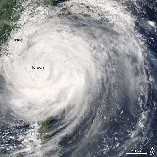
Super Typhoon Haitang is shown here bearing down on Taiwan on the morning of July 18, 2005. This image was captured by the Moderate Resolution Imaging Spectroradiometer (MODIS) on the Terra satellite at 02:20 UTC (10:20 p.m. Taipei time). At this time, the typhoon had weakened slightly from a Category 4 to Category 3 storm on the Saffir-Simpson scale. Sustained winds were around 200 kilometers per hour (105 knots) with peak gusts as high as 240 km/hr (130 knots).
The super typhoon has started to come ashore in Taiwan. As it crosses the island, the storm is losing some of its strength, but may then rebuild slightly as it crosses the Taiwan Straits and comes ashore again in eastern China. Projections call for it to make landfall in mainland China on July 19. In Taiwan, the storm has caused significant damage especially in the coastal towns of Hualien and Suao. At least one casuality has been due to the storm, where a woman was swept away by a flash flooding river in Taoyuan County, west of Taipei.
References & Resources
NASA image provided courtesy of Jeff Schmaltz, MODIS Rapid Response team.