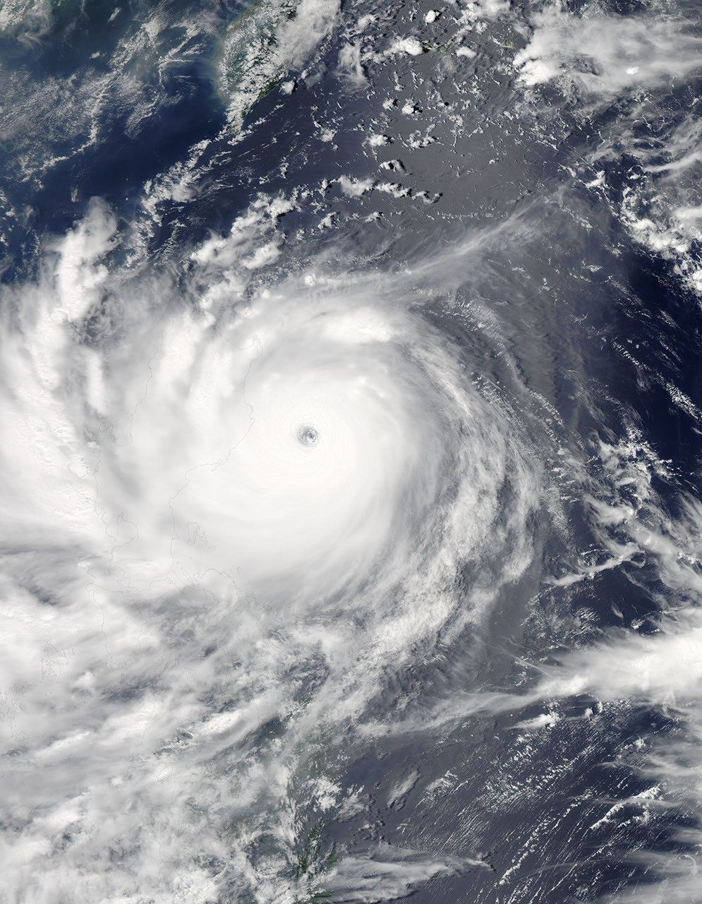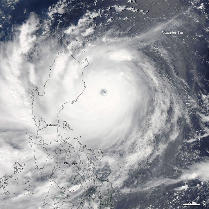
Nanmadol formed as a tropical depression over the western Pacific Ocean on August 22, 2011. It strengthened to a tropical storm a day later, and by August 26, it was a super typhoon.
The Moderate Resolution Imaging Spectroradiometer (MODIS) on NASA’s Aqua satellite captured this natural-color image of Super Typhoon Nanmadol at 12:50 p.m. Manila time on August 26, 2011. The eye of the storm appears east of the northern Philippines, and Nanmadol spans hundreds of kilometers.
As of 11:00 p.m. Manila time on August 26, 2011, the U.S. Navy’s Joint Typhoon Warning Center (JTWC) reported that Nanmadol had maximum sustained winds of 135 knots (250 kilometers, or 155 miles, per hour) and gusts up to 165 knots (305 kilometers, or 190 miles, per hour). The storm was located roughly 585 nautical miles (1,085 kilometers, or 675 miles) south-southwest of Kadena Air Base, Japan. The storm was forecast to continue traveling toward the north-northwest before turning toward the northeast.
On August 26, 2011, the Associated Press reported that at least one person in the Philippines was missing and several towns in the northern Philippines were flooded by heavy rains from the slow-moving storm.
References & Resources
- Associated Press. (2011, August 26). 1 missing as strong typhoon skirts Philippines. Accessed August 26, 2011.
- Joint Typhoon Warning Center. (2011, August 26). Super Typhoon 14W (Nanmadol) Warning. Accessed August 26, 2011.
- Unisys. (2011, August 26). Nanmadol Tracking Information. Accessed August 26, 2011.
NASA image courtesy MODIS Rapid Response Team at NASA GSFC. Caption by Michon Scott.