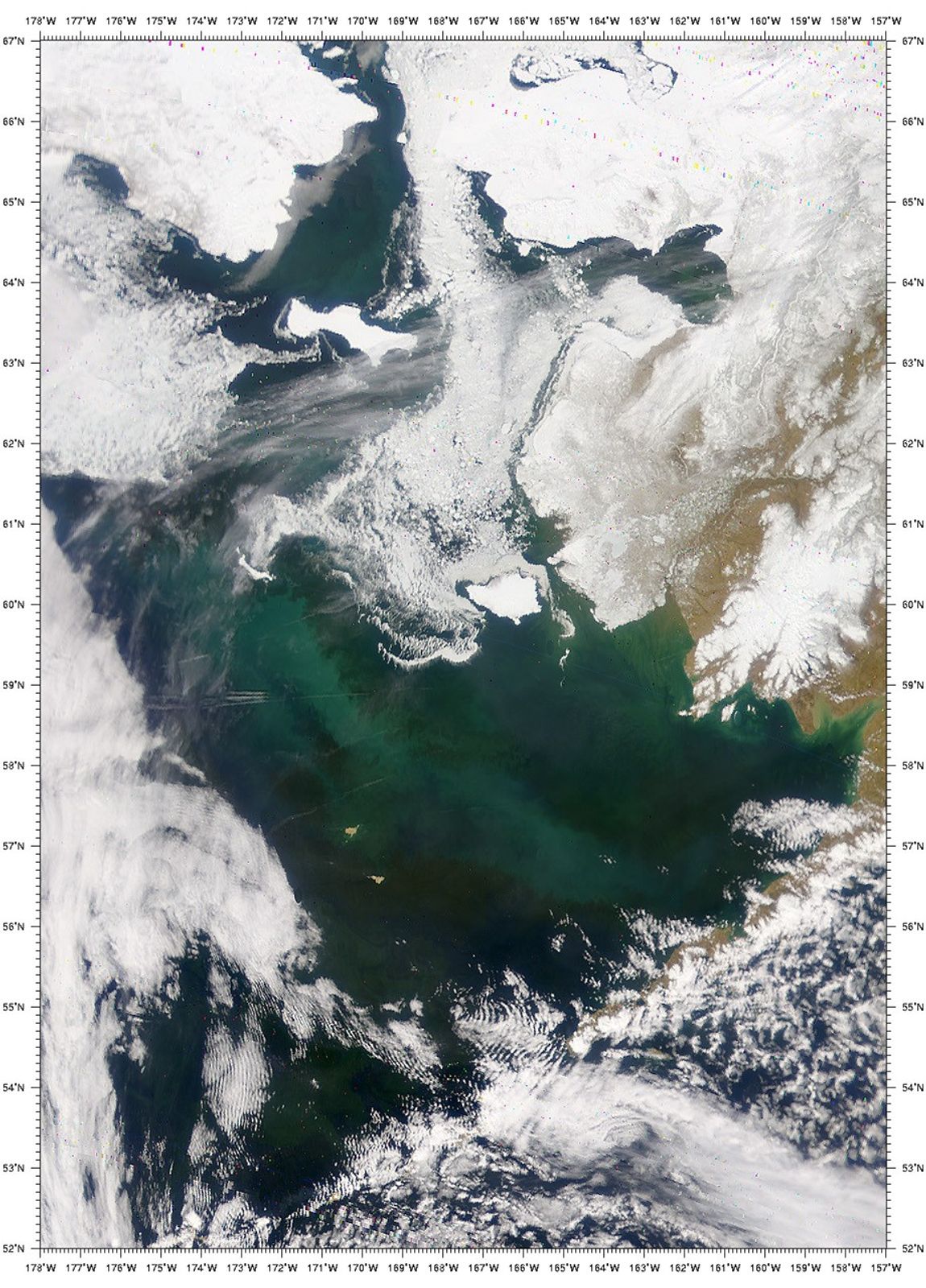
During a recent pass (May 13, 2001) over the Bering Sea, theSea-viewing Wide Field-of-view Sensor (SeaWiFS) captured this true-colorperspective of the region. The image shows a portion of the Bering Seafrom the west coast of Alaska to the international dateline. Noticethat the water is brightened by a large phytoplankton bloom,phytoplankton remains, or other detritus suspended near the surface.The varying intensities and shades of color correspond to differentspecies and concentrations of phytoplankton.
The passage of the Bering Strait can be seen at the top of the image,with St. Lawrence Island visible about 150 miles (240 km) south of thestrait. Roughly 200 miles (320 km) due south of St. Lawrence Island isthe smaller St. Matthew Island, at the northwestern end of thephytoplankton bloom, and Nunivak Island, just off the west coast ofAlaska. At the bottom of this picture, the Aleutian Islands are mostlyhidden by clouds.
References & Resources
Image provided by the SeaWiFS Project, NASA/Goddard Space Flight Center, and ORBIMAGE