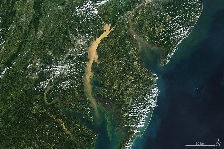
The Chesapeake Bay is the largest estuary in the United States and third largest in the world. Once sculpted by ice, water, and powerful geologic forces over tens of millions of years, today's Bay is shaped by human forces as well.
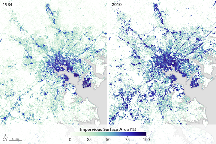
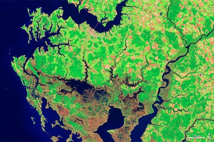
During the past half century, the watershed (image below) has become a landscape full of fast-spreading cities, suburbs, and farms. That development has clouded the water and reduced the productivity of the habitat. Scientists have been monitoring the Bay closely since the 1980s, and the news has often been troubling—waterways polluted with nitrogen and phosphorous, algae blooms, dead zones, and fish kills.
But glimmers of hope have begun to emerge, and efforts to clean up the Bay are starting to make a difference. The gains so far are small, and only careful monitoring will help scientists sort out which aspects of the cleanup are proving effective and which are not.
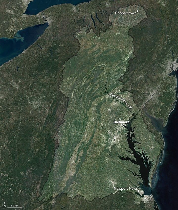
The series of stories and images below describes the natural and unnatural problems in the Chesapeake watershed, which stretches from upstate New York to Newport News.
Four-Part Feature Series
Click on each image for a deeper dive into one of the world's most famous and productive waterways.
Following a Raindrop from New York to Newport News
How Farms Affect the Chesapeake Bay’s Water
How Cities and Suburbs Affect Chesapeake Bay
Studying Chesapeake Bay from Above
Other Images of the Chesapeake Watershed
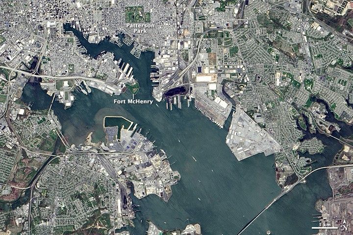
Star-Spangled City
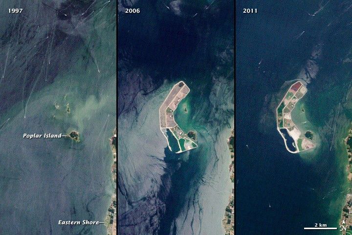
A Disappearing Island Restored
Blackwater National Wildlife Refuge
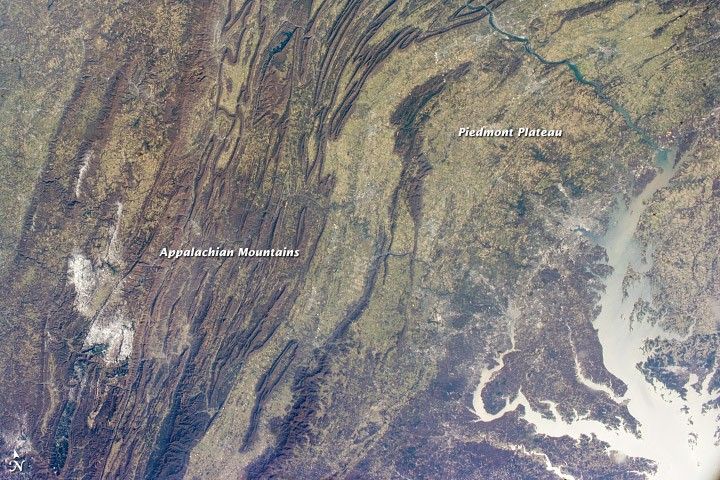
Appalachian Mountains
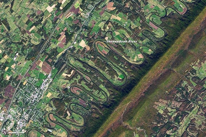
The Sinuous Shenandoah
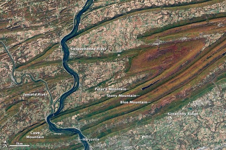
Fall Colors in Pennsylvania
NASA Earth Observatory story by Adam Voiland and Mike Carlowicz. Visuals by Joshua Stevens, Jesse Allen, and Mike Taylor.