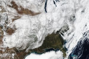
On May 20, 2013, a supercell thunderstorm in central Oklahoma spawned a destructive tornado that passed just south of Oklahoma City. The Moderate Resolution Imaging Spectroradiometer (MODIS) on NASA’s Aqua satellite acquired this natural-color image of the storm system at 2:40 p.m. Central Daylight Time (19:40 Universal Time), just minutes before the devastating twister began.
The red line on the image depicts the tornado’s track. It touched down west of Newcastle at 2:56 p.m. and moved northeast toward Moore, where it caused dozens of deaths, hundreds of injuries, and widespread destruction to property and public buildings. The tornado had dissipated by 3:36 p.m., after traveling approximately 17 to 20 miles (27 to 32 kilometers).
According to National Weather Service and media reports, the mile-wide tornado had a preliminary damage rating of EF-4, with winds reaching 190 miles per hour. It had a relatively slow forward speed for such a violent storm—about 20–25 miles per hour—likely exacerbating the damage. Debris from the tornado fell as far as 100 miles (160 kilometers) away, reaching the city of Tulsa.
Below is time-lapse video of the storm system as viewed by the National Oceanic and Atmospheric Administration’s GOES-East satellite. Images were acquired every 15 minutes from 10:45 a.m. through 6:45 p.m. Central Daylight Time on May 20. You can also click here to download a quicktime version of the video. Jeff Masters of Weather Underground has also posted several ground-based videos here. And meteorologists in NASA’s Short-term Prediction Research and Transition Center posted several experimental views of the storm-damaged area at night.
Further Reading
- NASA (2013, May 21) Satellites See Storm System that Created Moore, Okla., Tornado. Accessed May 21, 2013.
- NASA Explorer (2012, May 24) Interview: Tornadoes with Tim Samaras. Accessed May 21, 2013.
- National Weather Service Jetstream (2011, April 18) Types of thunderstorms. Accessed May 21, 2013.
- National Weather Service Jetstream (2011, April 18) Thunderstorm hazards—tornadoes. Accessed May 21, 2013.
- NOAA National Climatic Data Center (2013, May 17) U.S. Tornado Climatology. Accessed May 21, 2013.
References & Resources
- NewsOK, The Daily Oklahoman (2013, May 21) Live: Moore tornado recovery efforts, stories. Accessed May 21, 2013.
- NOAA Storm Prediction Center (2013, May 20) SPC Storm Reports for 05/20/13. Accessed May 21, 2013.
- NOAA (2013, May 20) Newcastle-Moore-South OKC Preliminary Tornado Track. Accessed May 21, 2013.
- The Washington Post (2013, May 20) Huge tornado levels Oklahoma City suburb, killing scores. Accessed May 21, 2013.
- Weather Underground (2013, May 21) Violent tornado devastates Moore, Oklahoma. Accessed May 21, 2013.
- Weather Underground (2013, May 21) Violent tornado causes catastrophic damage in Moore, Oklahoma. Accessed May 21, 2013.
NASA image courtesy Jeff Schmaltz, LANCE/EOSDIS MODIS Rapid Response Team at NASA GSFC. NASA Earth Observatory animation by Robert Simmon, using images from GOES Project Science. Caption by Mike Carlowicz and Adam Voiland.

