


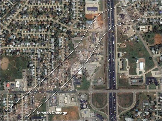
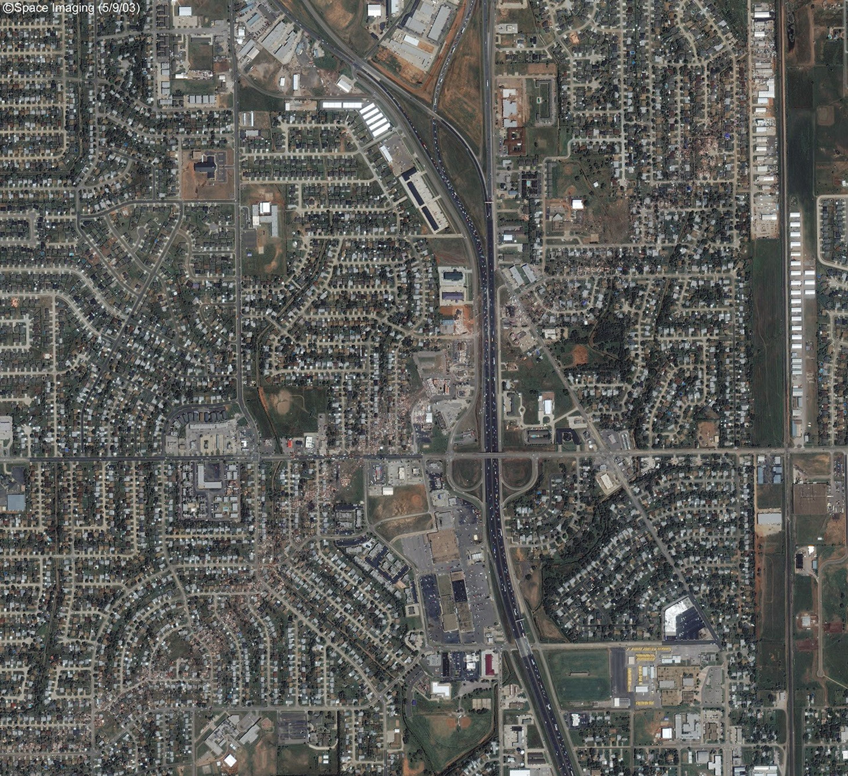
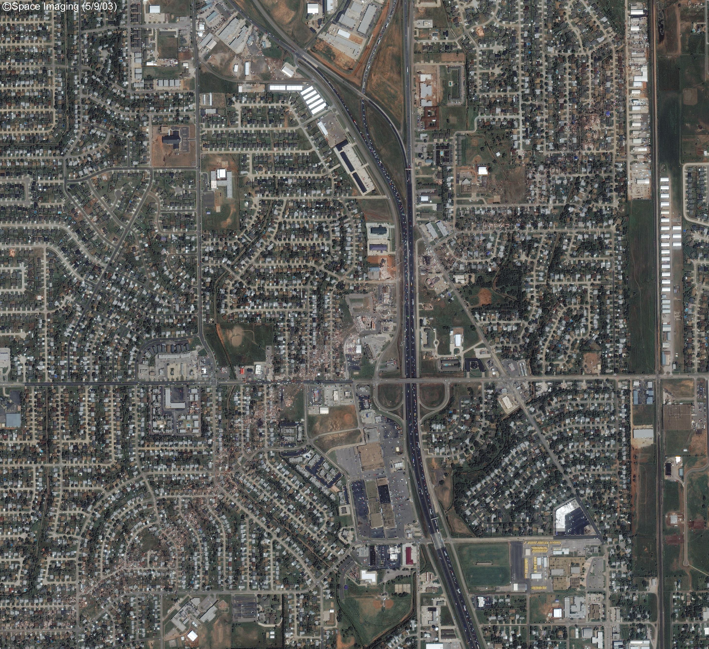
On May 3, 2003, a group of intense supercell thunderstorms spawned multiple tornados that swept across Oklahoma and nearby states. One of the tornados touched down in the town of Moore, just south of Oklahoma City. The path of the tornado is visible in this high-resolution satellite image, acquired by the IKONOS satellite on May 10, 2003. In the center of the tornado’s swath homes were totally destroyed. The satellite’s 1-meter maximum resolution reveals the extent of the destruction.
For more information about the tornado outbreak, read: The Central Oklahoma Tornado Outbreak of May 3, 1999 from NOAA.
References & Resources
© All Rights Reserved: Use of IKONOS, GeoEye, QuickBird and WorldView imagery must be coordinated with Maxar.
Image copyright DigitalGlobe © All Rights Reserved: Use of IKONOS, GeoEye, QuickBird, WorldView, and Digital Globe imagery must be coordinated with Maxar .


