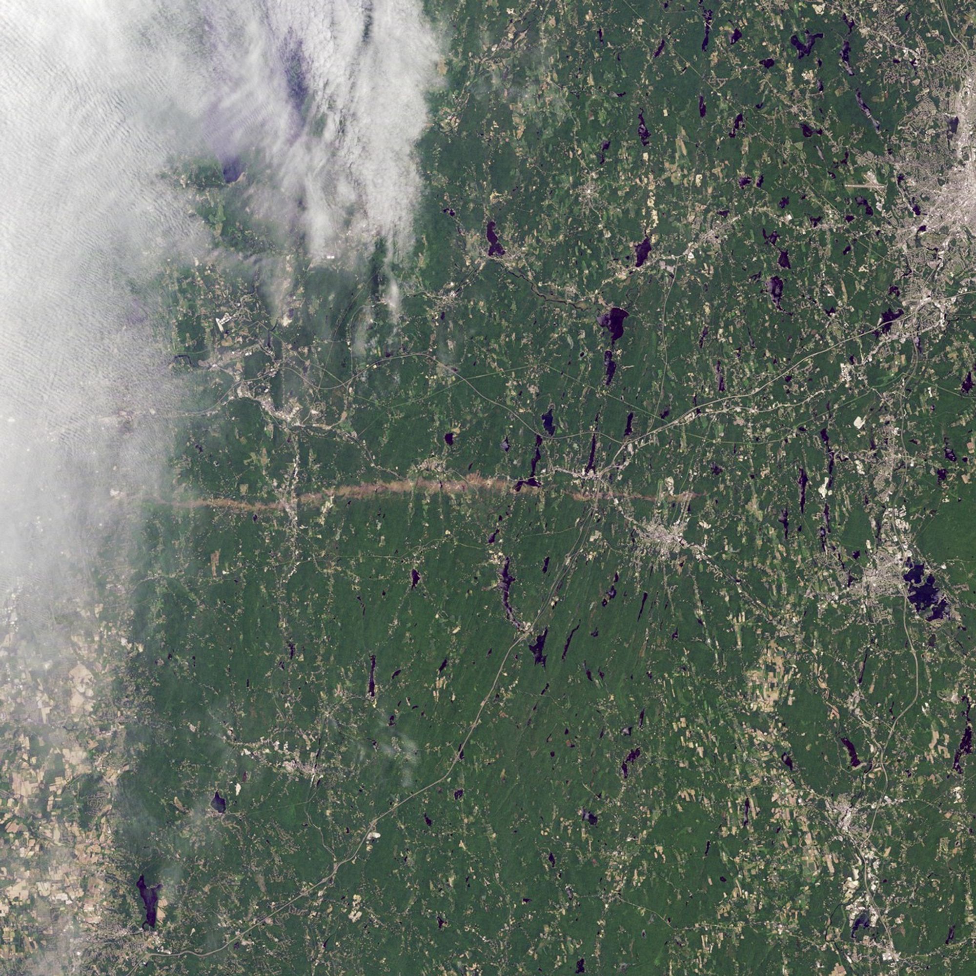


On June 1, 2011, a supercell thunderstorm developed over western Massachusetts. The storm produced an EF3 tornado that cut a 39-mile (63-kilometer) track of destruction across southwest and south-central Massachusetts. Not only did the tornado remain on the ground for many miles, but it also widened to roughly 0.5 miles (0.8 kilometers) in Brimfield State Forest.
The Thematic Mapper on the Landsat 5 satellite captured this natural-color image on June 5, 2011, showing part of the tornado track including damage in Sturbridge. According to The Boston Globe, Massachusetts state police reported a tornado on the ground and cars overturned near Interstate 84 in Sturbridge at 5:22 p.m. on June 1.
When the tornado first touched down in the Munger Hill section of Westfield, Massachusetts, damage was mostly limited to trees, the National Weather Service reported. The tornado quickly intensified, however, as it traveled to West Springfield. The Boston Globe reported two deaths in West Springfield, one in Springfield, and another in Brimfield. The number of people injured was unknown the day after the storm, but 33 people were known to have been injured in Springfield alone.
Massachusetts Governor Deval Patrick declared a state of emergency and ordered National Guard troops to assist with cleanup efforts. Tornadoes killed at least four residents, while reducing homes, schools, and churches to rubble.
Deadly tornadoes are unusual, but not unheard of, in Massachusetts. In 1953, one of the single deadliest tornadoes in U.S. history struck Worcester, killing 94 people.
References & Resources
- Boston Globe. (2011, June 2). Tornado damage graphic. Accessed June 6, 2011.
- Boston Globe. (2011, June 2). Tornadoes kill four, emergency is declared. Accessed June 6, 2011.
- National Weather Service, Taunton, Massachusetts. (2011, June 3). Public Information Statement. Accessed June 6, 2011.
NASA Earth Observatory image created by Jesse Allen, using Landsat data provided by Julia Barsi of the Landsat Project Science Office. Landsat is jointly managed by the U.S. Geological Survey and NASA. Caption by Michon Scott.