


- Rain Rate, March 31, 2008 (607 kB jpg)
- Rainfall Totals, March 25–April 1, 2008 (178 kB jpg)
Numerous storms, flooding, and severe weather swept from the Southern Plains into the central Mississippi Valley on March 31, 2008. Low pressure over the Plains drew warm, humid air up from the Gulf of Mexico into the central part of the country. Thunderstorms dropped hail over parts of northeastern Texas and eastern Arkansas on Saturday, March 29, and on central Oklahoma and Kansas the next day. On Monday, tornadoes and widespread hail pummeled Oklahoma and Missouri.
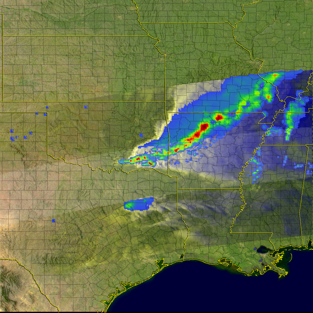
These images show the intense rain brought by the storm system. The top image shows a snapshot of the rainfall within a storm complex that extended from southeastern Oklahoma through northern Arkansas and into southeastern Missouri. The image is made from data collected by the Tropical Rainfall Measuring Mission (TRMM) satellite at 7:03 p.m. CDT on March 31 (00:03 UTC on April 1, 2008). The storms are oriented in a southwest-to-northeast line. The most intense rain tends to be right along the leading edge (red areas). A broad area of light rain (blue) extends to the rear of the system (north in this orientation). At the time this image was taken, hail was being reported in southeastern Oklahoma.
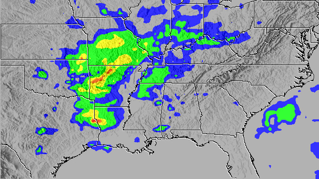
The lower image shows MPA rainfall totals between March 25 and April 1, 2008, for the central United States. Rain amounts exceed 50 millimeters (about 2 inches, shown in green) in an area from northeast Texas through the lower half of Missouri. Significant portions of Missouri and Arkansas received at least 100 mm (about 4 inches, shown in yellow), while as high as 200 mm (about 8 inches, shown in red) of rain fell in a small area near the Texas-Louisiana border.
The TRMM satellite has several types of remote sensors. Rain rates in the center of the swath are from the TRMM Precipitation Radar, while those in the outer swath are from the TRMM Microwave Imager. The rain rates are overlaid on infrared data from the TRMM Visible Infrared Scanner.
TRMM is a joint mission between NASA and the Japanese space agency, JAXA.
References & Resources
Images produced by Hal Pierce (SSAI/NASA GSFC) and caption by Steve Lang (SSAI/NASA GSFC).


