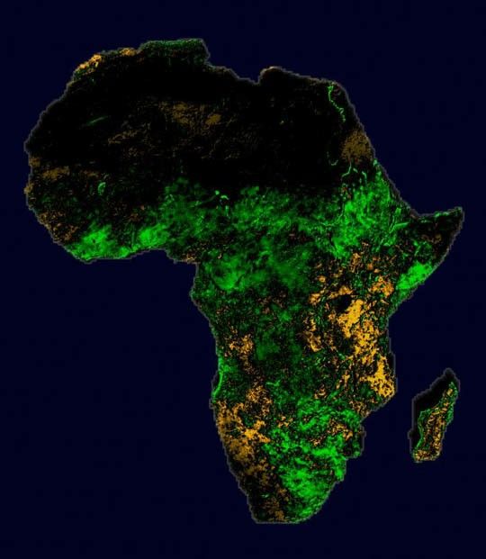
Using weather satellites to spot the early signs of El Niño, scientists may be able to save East Africans and their livestock from Rift Valley Fever, a mosquito-borne disease that can be fatal to humans and animals.
By closely monitoring the vegetation in the region affected by increased rainfall, scientists can identify the actual areas affected by outbreaks of Rift Valley Fever. Scientists use satellite images to show regions of Africa that are greener (and wetter) than normal or more brown (and drier) than normal.
This new research was published in the journal Science ("Climate and Satellite Indicators to Forecast Rift Valley Fever Epidemics in Kenya." Linthicum, K. J., et al., July 16, 1999).
References & Resources
Data Source: NOAA AVHRR / Normalized Difference Vegetative Index; NASA
None