.png?w=1024)


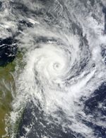
Tropical Cyclone Bingiza made landfall on Madagascar on February 14, 2011. The U.S. Navy’s Joint Typhoon Warning Center (JTWC) reported that, as of about noon local time on the 14th, Bingiza had maximum sustained winds of 85 knots (155 kilometers per hour) and gusts up to 105 knots (195 kilometers per hour). The storm was located roughly 250 nautical miles (465 kilometers) northeast of Antananarivo.
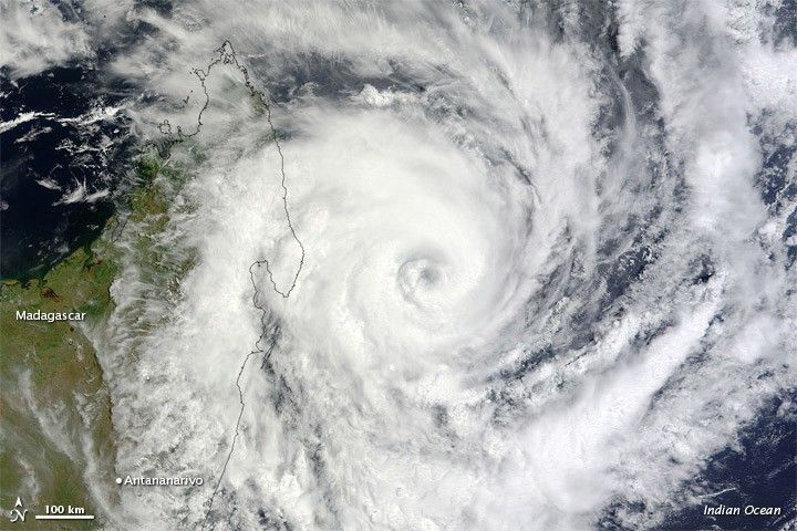
The Moderate Resolution Imaging Spectroradiometer (MODIS) on NASA’s Terra satellite captured this natural-color image at 10:00 a.m. local time on February 13, 2011. Bingiza’s eye approaches northern Madagascar, and a spiral arm grazes Antananarivo.
Although Bingiza would weaken somewhat over land, the storm was expected to re-strengthen after passing over northern Madagascar, thanks to high sea surface temperatures. The JTWC forecast that the storm would travel southward, roughly tracing the Madagacar’s west coast.
References & Resources
- Joint Typhoon Warning Center. (2011, February 14). Tropical Cyclone 13S (Bingiza) Warning. Accessed February 14, 2011.
NASA image by Jeff Schmaltz, MODIS Rapid Response Team at NASA GSFC. Caption by Michon Scott.