Suggested Searches

1 min read

Tropical Cyclone Gafilo

Instruments:
2004-03-03 00:00:00
March 3, 2004

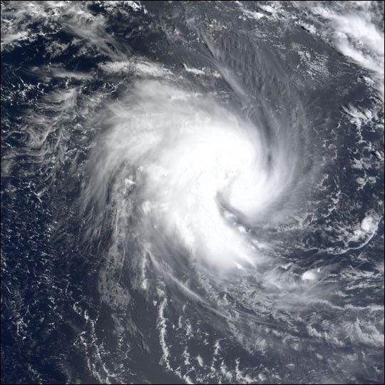
The MODIS instrument onboard NASA's Terra satellite captured this true-color image of Tropical Cyclone Gafilo as it was churning in the Indian Ocean approximately 800 miles northwest of northern Madagascar. At the time this image was acquired, Gafilo had maximum sustained winds near 75 mph and was moving west at 8 mph. Gafilo was expected to strengthen and take a turn towards the southwest and possibly affect northern Madagascar by the weekend.

References & Resources

Image courtesy Jesse Allen, NASA Earth Observatory at NASA GSFC.

You may also be interested in:

Stay up-to-date with the latest content from NASA as we explore the universe and discover more about our home planet.

A Second Cyclone Slams Madagascar
3 min read

Widespread flooding affected tens of thousands of people after cyclones Fytia and Gezani drenched the island.

Article
Dry-Season Floods Drench Northern Colombia
3 min read

Villages and farmland were swamped after unusually heavy early-February rains pushed the Sinú River over its banks.

Article
Ragasa Steers Toward China
3 min read

The super typhoon headed for Guangdong province after lashing Taiwan and northern Luzon in the Philippines.

Article