Suggested Searches

1 min read

Tropical Cyclone Gina

Instruments:
2024-06-06 12:00:00
June 6, 2003

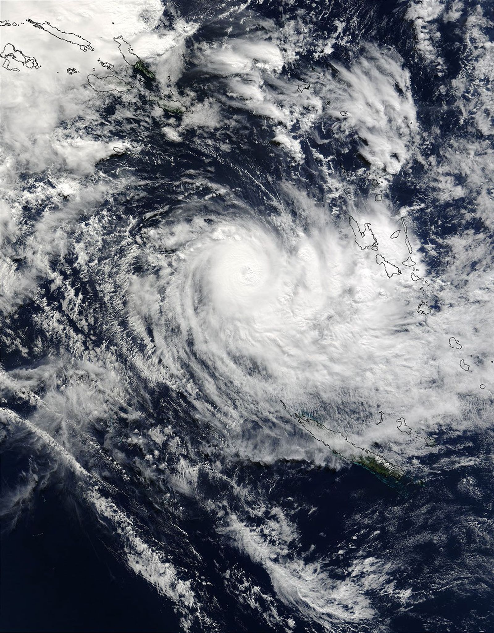
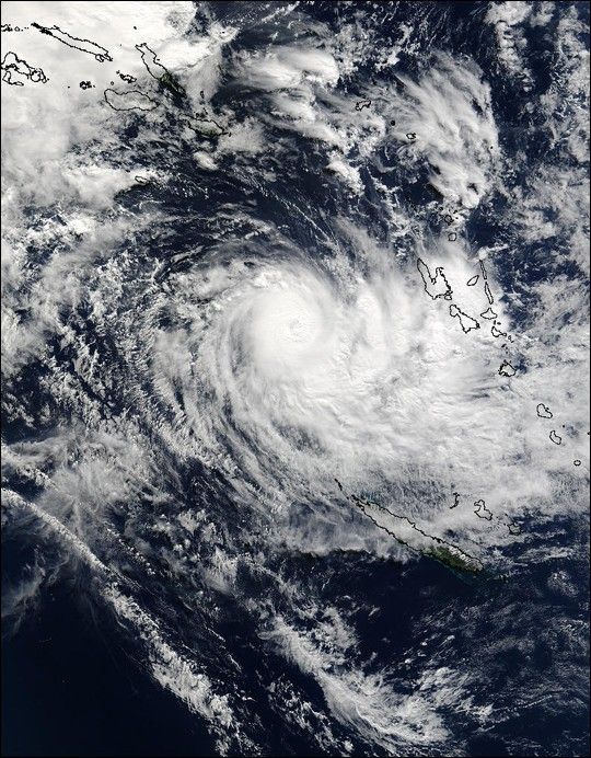
On June 6, 2003, the MODIS instrument onboard NASA's Terra satellite captured this bird's-eye view of Tropical Cyclone Gina as it was located approximately 495 miles (792 km) north-northwest of Noumea, New Caledonia. Gina was packing sustained winds near 89 mph with higher gusts to 104 mph. Since this strong low pressure system is located south of the equator, the winds associated with Gina are spinning in a clockwise motion.

References & Resources

Image courtesy Jeff Schmaltz, MODIS Rapid Response Team, NASA GSFC

You may also be interested in:

Stay up-to-date with the latest content from NASA as we explore the universe and discover more about our home planet.

Dust Engulfs Coastal Peru
3 min read

Skies turned orange across the city of Ica as winds, locally known as Paracas winds, lofted dust from the coastal…

Article
Hurricane Erin Roils in the Atlantic
3 min read

The major hurricane steered clear of land but delivered tropical storm conditions to coastal areas along its path.

Article
Senyar Swamps Sumatra
3 min read

A rare tropical cyclone dropped torrential rains on the Indonesian island, fueling extensive and destructive floods.

Article