


![Request for Information – Potential [Placeholder for Prize]](https://assets.science.nasa.gov/dynamicimage/assets/science/missions/a-step/FFR_Earth_Background_20251120%20.png?w=1024)


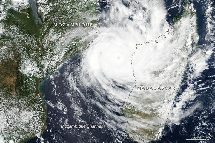
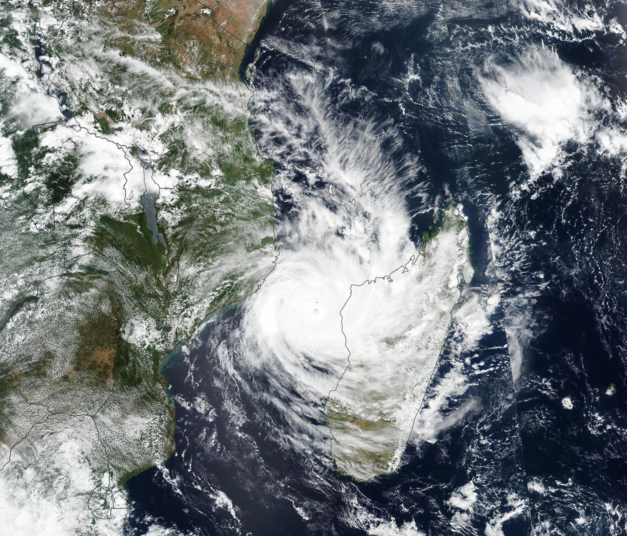
Tropical Cyclone Idai is poised to move inland over East African countries that have already been soaked with rain by the same storm system.
The Visible Infrared Imaging Radiometer Suite (VIIRS) on the Suomi NPP satellite acquired this image of the cyclone on March 11, 2019, as it spun across the Mozambique Channel. Around this time, the potent category 3 storm carried maximum sustained winds of about 105 knots (120 miles per hour).
One week earlier, the developing storm delivered high winds and heavy rain to Mozambique and Malawi, where it caused deadly floods. The disturbance intensified into a major tropical cyclone over the warm channel between the southeast coast of Africa and Madagascar. Forecasters are calling for Idai to make landfall on Mozambique later this week, bringing a second round of wind and rain to the region.
References & Resources
- Joint Typhoon Warning Center (2019, March 11) Tropical Cyclone 18S (IDAI) Warning #10. Accessed March 11, 2019.
- Memeburn (2019, March 11) What you need to know about Tropical Cyclone Idai, set to strike Mozambique. Accessed March 11, 2019.
- Reuters (2019, March 10) Death toll from Malawi flooding rises to 28, almost 227,000 people affected. Accessed March 11, 2019.
NASA Earth Observatory image by Lauren Dauphin, using VIIRS data from the Suomi National Polar-orbiting Partnership. Caption by Kathryn Hansen.


