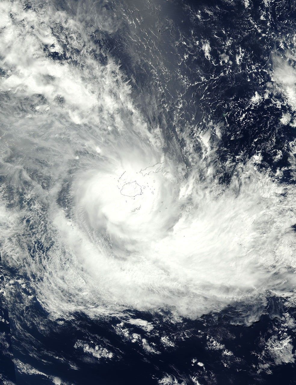
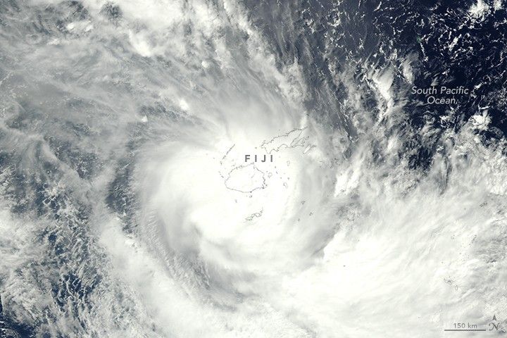
At 1:24 p.m. local time (01:24 Universal Time) on April 10, 2018, the Visible Infrared Imaging Radiometer Suite (VIIRS) on the NOAA-20 satellite (formerly JPSS-1) acquired this natural-color image of Cyclone Keni over Fiji.
At the time, the storm had sustained winds of 70 knots (80 miles/130 kilometers per hour) according to estimates from the U.S. Joint Typhoon Warning Center. It was a category 1 storm on the Saffir-Simpson scale. Soon after this image was acquired, Keni strengthened to a category 2 storm. Vertical wind shear and cooler sea surface temperatures caused it to weaken on April 11.
According to news reports, the storm caused flooding on Fiji’s Viti Levu and Kadavu islands. The region had already been soaked by heavy rains that accompanied Cyclone Josie earlier in the month.
References & Resources
- Al Jazeera and News Agencies (2018, April 11) Tropical Cyclone Keni makes a direct hit on Fiji. Accessed April 11, 2018.
- Radio New Zealand (2018, April 6) Fiji likely to be hit by another cyclone along Josie's path. Accessed April 11, 2018.
- Unisys Weather (2018) Cyclone-2 KENI. Accessed April 11, 2018.
NASA Earth Observatory images by Jeff Schmaltz, using data from LANCE/EOSDIS Rapid Response . Caption by Kathryn Hansen.