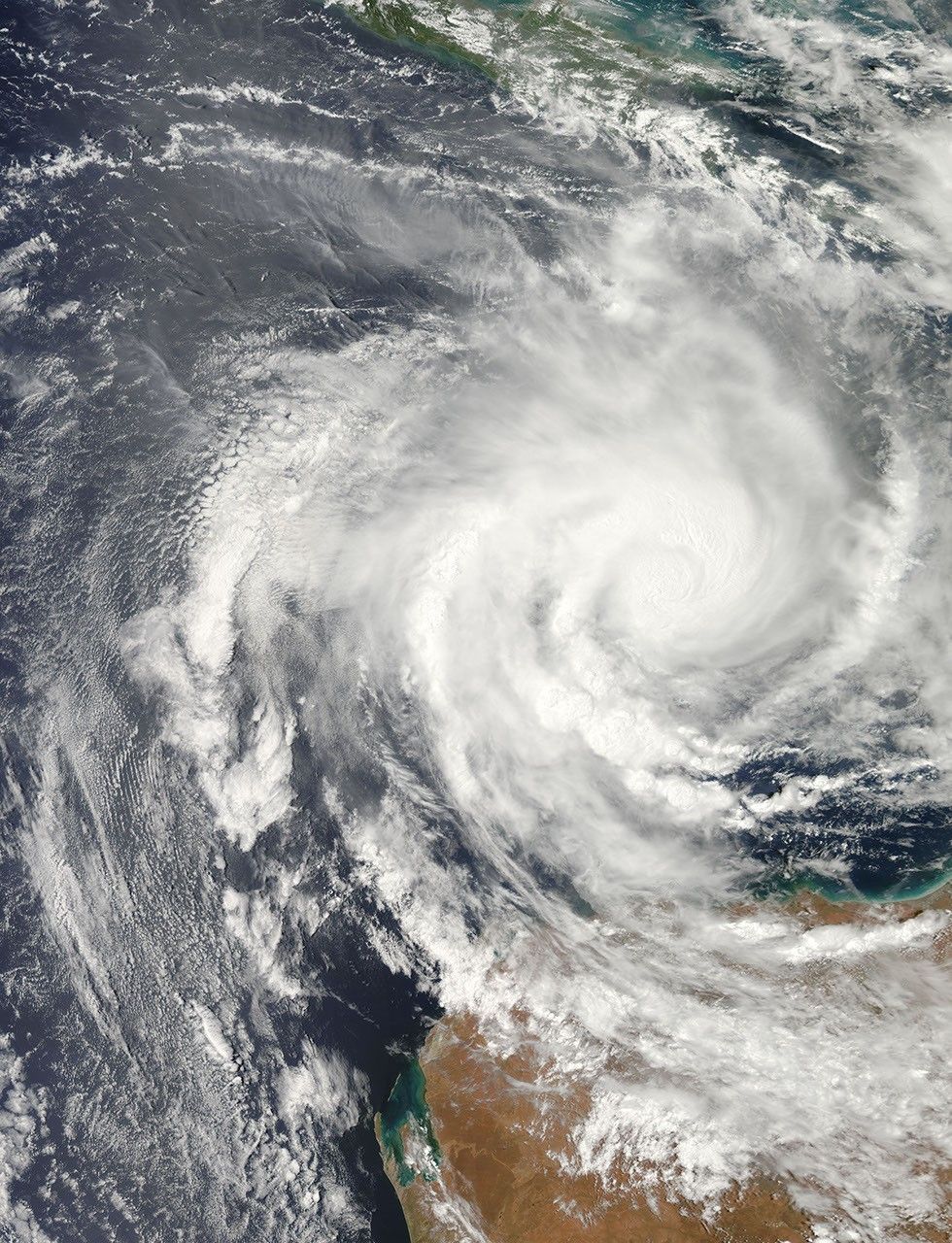
Narelle formed as a tropical storm over the southern Indian Ocean on January 7, 2013, and strengthened into a cyclone two days later. On January 10, the U.S. Navy’s Joint Typhoon Warning Center (JTWC) reported that Narelle had maximum sustained winds of 80 knots (150 kilometers per hour), with gusts up to 100 knots (185 kilometers per hour). Over the next 48 hours, wind speeds were forecast to increase to 115 knots (215 kilometers per hour) with gusts up to 140 knots (260 kilometers per hour).
The Moderate Resolution Imaging Spectroradiometer (MODIS) on NASA’s Aqua satellite captured this natural-color image on January 10. The JTWC reported that Narelle was roughly 370 nautical miles (685 kilometers) north of Learmonth, Australia. The JTWC projected that Narelle would continue moving toward the south-southwest before making a slight turn toward the southeast. The storm was forecast to travel along the Australia coast and to gradually weaken as it moved southward.
References & Resources
- Joint Typhoon Warning Center. Accessed January 10, 2013.
- Unisys Weather. (2013, January 10) Narelle Tracking Information. Accessed January 10, 2013.
NASA image courtesy Jeff Schmaltz, LANCE MODIS Rapid Response. Caption by Michon Scott.