


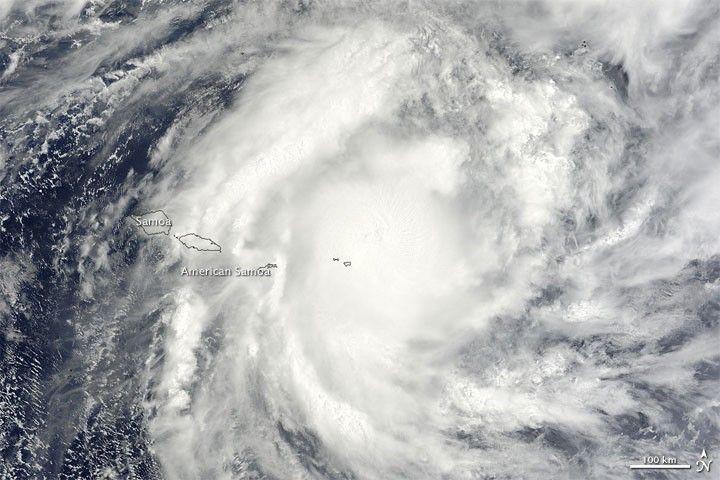
Tropical Cyclone Rene spanned hundreds of kilometers over the Southern Pacific Ocean in mid-February 2010. On February 13, the U.S. Navy’s Joint Typhoon Warning Center (JTWC) reported that Rene had maximum sustained winds of 100 knots (185 kilometers per hour) and gusts up to 125 knots (230 kilometers per hour).
The Moderate Resolution Imaging Spectroradiometer (MODIS) on NASA’s Terra satellite captured this true-color image at 10:40 a.m. Pago Pago, American Samoa, time (21:40 UTC) on February 12, 2010. Here, Rene’s center appears roughly 73 nautical miles (140 kilometers) east-northeast of American Samoa. By the following day, the JTWC reported that the storm’s center was some 85 nautical miles (160 kilometers) south-southeast of Pago Pago.
References & Resources
- Joint Typhoon Warning Center. (2010, February 13). Tropical Cyclone 15P (Rene) Warning. Accessed February 13, 2010.
NASA image image by Jeff Schmaltz, MODIS Rapid Response Team at NASA GSFC. Caption by Michon Scott.


