![Request for Information – Potential [Placeholder for Prize]](https://assets.science.nasa.gov/dynamicimage/assets/science/psd/solar/2023/09/s/solarsystem_0.jpg?w=1024)


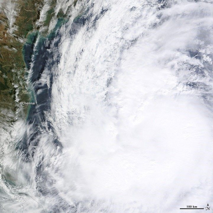
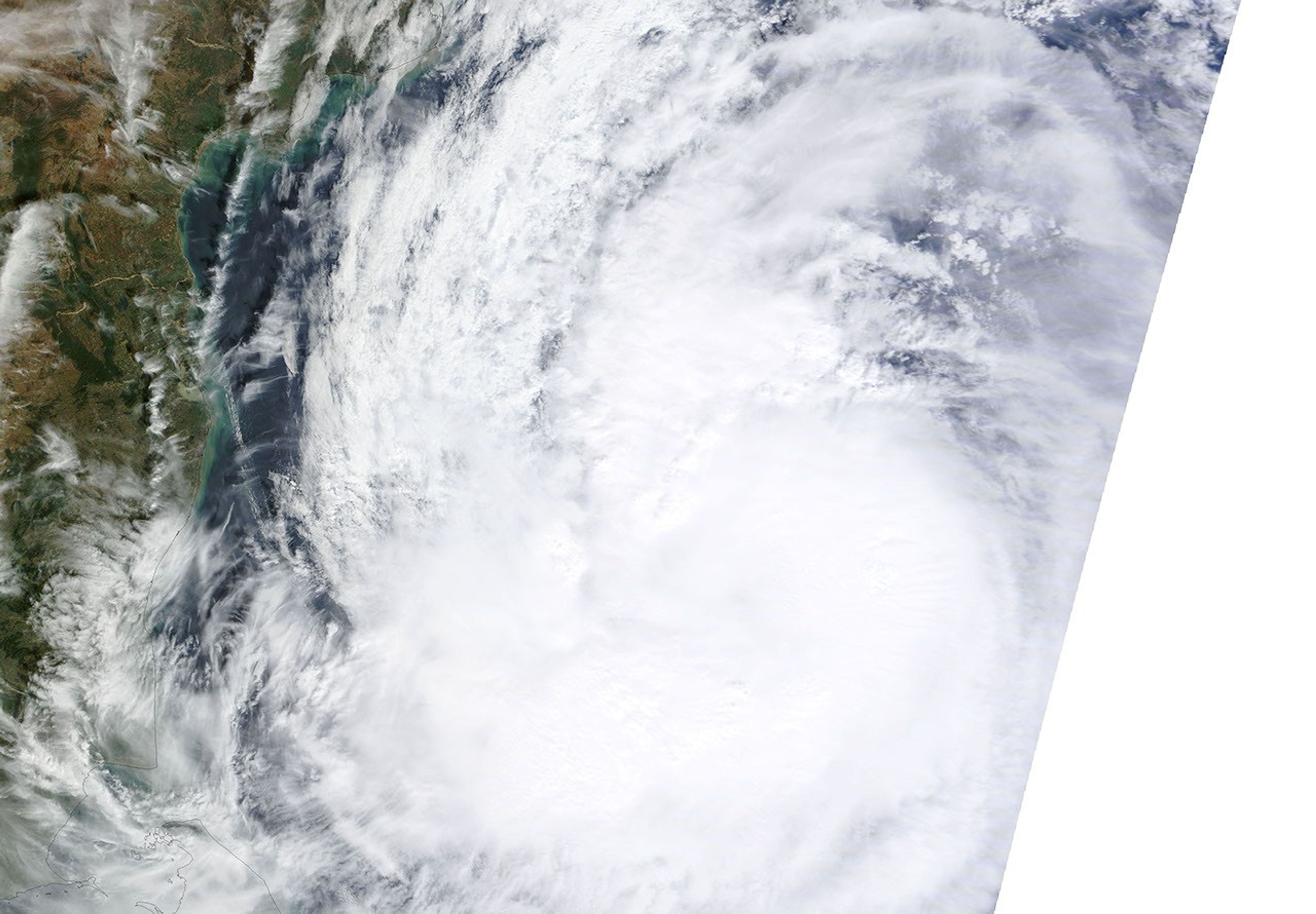
Tropical Storm Thane formed over the Indian Ocean on December 25, 2011. By December 28, Thane had strengthened into a cyclone and was headed toward southern India. On December 28, the U.S. Navy’s Joint Typhoon Warning Center (JTWC) reported that Thane was located roughly 270 nautical miles (500 kilometers) southeast of Chennai. The storm had maximum sustained winds of 65 knots (120 kilometers per hour) with gusts up to 80 knots (150 kilometers per hour).
The Moderate Resolution Imaging Spectroradiometer (MODIS) on NASA’s Terra satellite captured this natural-color image on December 28, 2011. Thane lacks a distinct eye but still sports the spiral shape characteristic of strong storms. Skies are clear over Chennai but storm clouds extend over other parts of the Indian coast.
The JTWC forecast that Thane would continue moving toward the west, making landfall south of Chennai on December 30.
References & Resources
- Joint Typhoon Warning Center. (2011, December 28). Tropical Cyclone 06B (Thane) Warning. Accessed December 28, 2011.
- Unisys. (2011, December 28). Thane Tracking Information. Accessed December 28, 2011.
NASA image courtesy LANCE/EOSDIS MODIS Rapid Response Team at NASA GSFC. Caption by Michon Scott.