


June 20, 2010
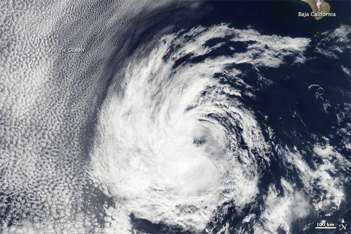
Tropical Depression Blas lingered over the eastern Pacific Ocean in late June 2010. On June 21, 2010, the U.S. Navy’s Joint Typhoon Warning Center (JTWC) reported that Blas had maximum sustained winds of 30 knots (55 kilometers per hour) and gusts up to 40 knots (75 kilometers per hour), the same wind speeds as on June 20. The JTWC projected storm track showed Blas moving farther away from land.
The Moderate Resolution Imaging Spectroradiometer (MODIS) on NASA’s Aqua satellite captured this true-color image of Blas on June 20, 2010. Shaped like a backward comma, the storm has a spiral arm that almost reaches Baja California.
References & Resources
- Joint Typhoon Warning Center. (2010, June 21). Tropical Depression 03E (Blas) Warning. Accessed June 21, 2010.
NASA image courtesy MODIS Rapid Response Team at NASA GSFC. Caption by Michon Scott.


