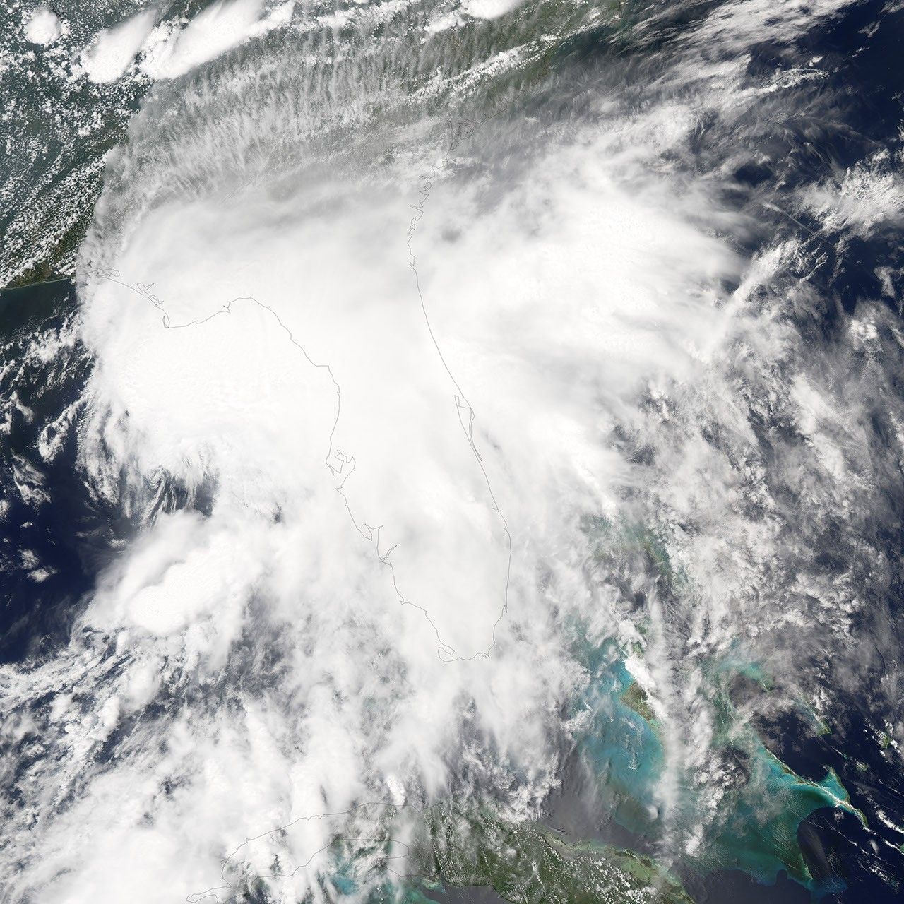
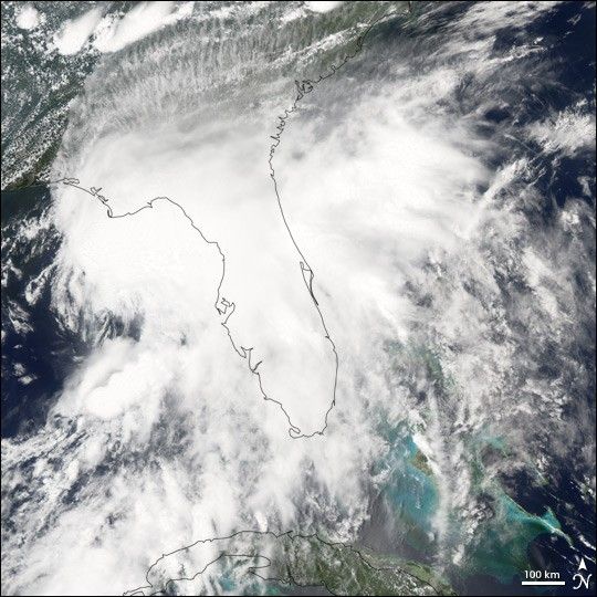
Tropical Storm Alberto formed as a tropical depression early in the morning on June 10, 2006, in the Yucatan Channel. Alberto gradually gathered strength as it took a slow track northward into the Gulf. By early morning on June 11, wind strength within the storm crossed the critical threshold of 39 knots (70 kilometers per hour; 45 miles per hour). Thus Alberto became the first named storm of the 2006 Atlantic hurricane season. Although Alberto briefly flirted with hurricane status as wind speeds came close to the necessary 64 knots (118 km/hr; 74 mph), the system remained a strong tropical storm as of the morning of June 13, and it was projected to weaken as it comes ashore in northern Florida.
This photo-like image was acquired by the Moderate Resolution Imaging Spectroradiometer (MODIS) on the Aqua satellite on June 12, 2006, at 2:35 p.m. local time (18:35 UTC). The tropical storm did have hints of a spiral structure, but as in earlier satellite images, the bulk of the clouds and rainfall from the storm were east of the storm’s center. This large mass of clouds in the image appears over the Florida panhandle and mainland Florida, while the wind circulation center is located roughly 200 kilometers (120 miles) to the west of Tampa.
Sustained winds in the storm system were estimated to be around 110 kilometers per hour (70 miles per hour) around the time the image was captured, according to the University of Hawaii’s Tropical Storm Information Center. However, the less-than-hurricane-strength winds did not mean that Alberto posed no significant hazards. Rainfall totals from the storm were predicted to be between 12 to 25 centimeters (5 to 10 inches), and the storm center was also expected to spawn tornadoes once Alberto crossed land. Drought-stricken Florida was looking for rain, but the heavy downpours predicted were also causing concerns about local flooding.
References & Resources
NASA image created by Jesse Allen, Earth Observatory, using data obtained courtesy of the MODIS Rapid Response team.