![Request for Information – Potential [Placeholder for Prize]](https://assets.science.nasa.gov/dynamicimage/assets/science/missions/a-step/FFR_Earth_Background_20251120%20.png?w=1024)


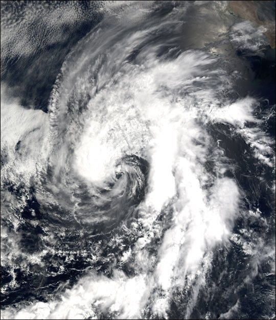
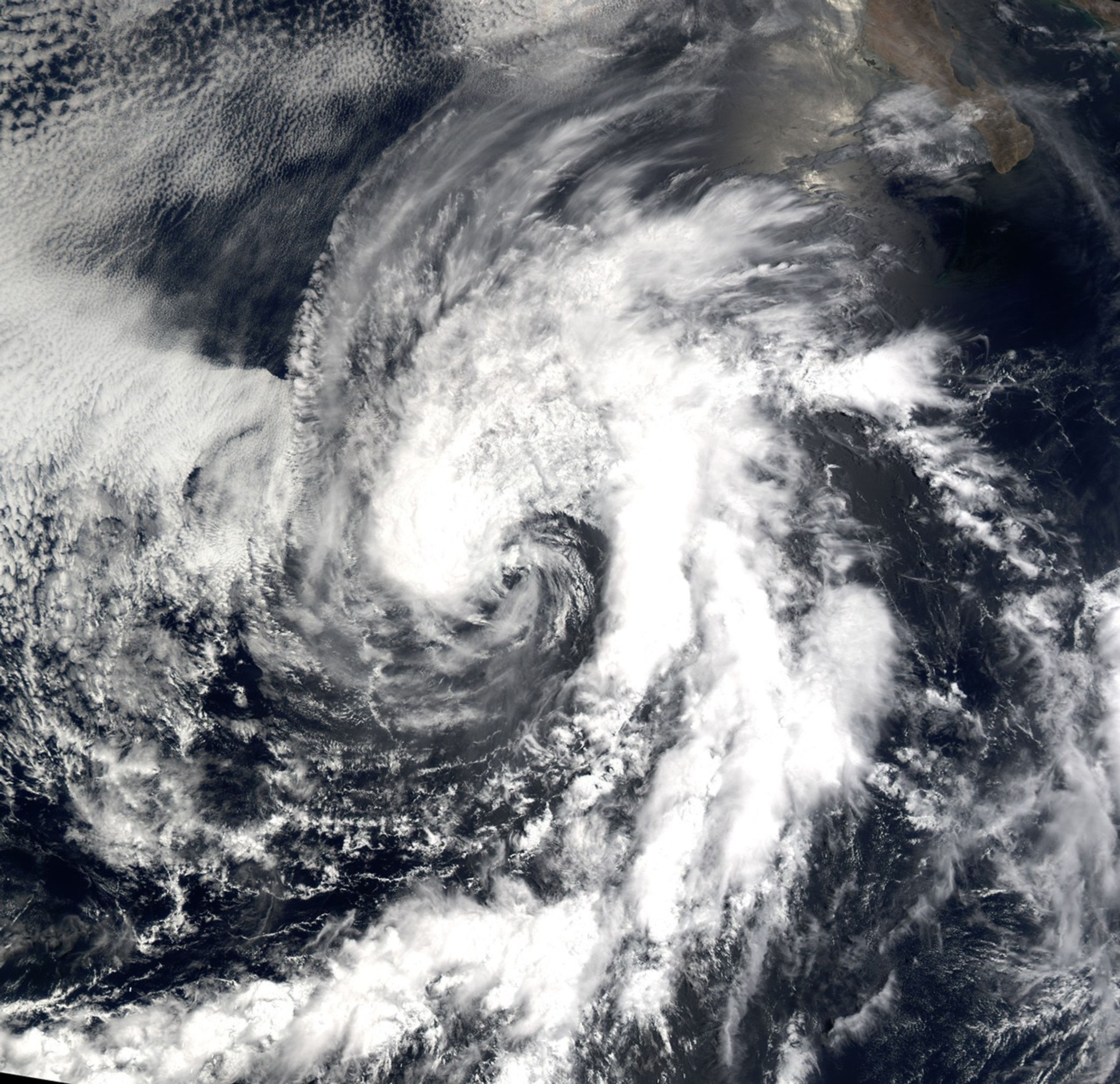
Now downgraded to a tropical depression, Tropical Storm Cristina can be seen at full strength in this true-color image taken on July 14, 2002, by the Moderate Resolution Imaging Spectroradiometer (MODIS), flying aboard NASA’s Terra spacecraft. The land in the upper right-hand corner is Baja California.
The typhoon, which formed to the south a few days ago, moved northward and headed toward Baja California before turning west and dissipating in the eastern Pacific. When this image was taken, the tropical storm bore sustained winds of over 63 kilometers (39 miles) per hour. Currently, sustained winds are at 46 kilometers (28 miles) per hour.
References & Resources
Image courtesy Jesse Allen, NASA Earth Observatory; Data provided by the MODIS Land Rapid Response Team at NASA GSFC