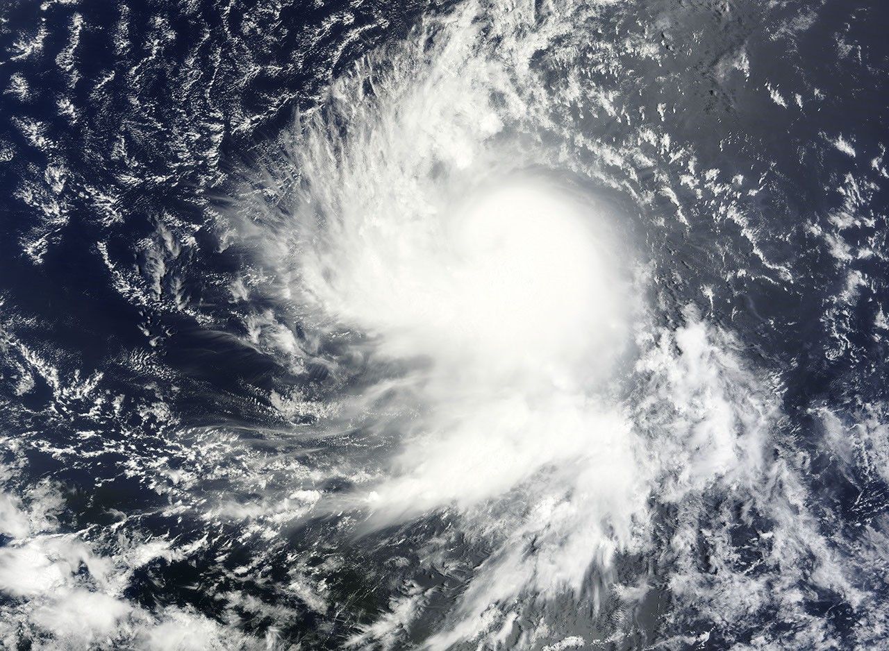
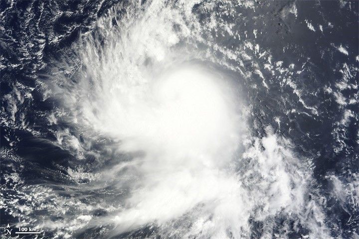
Tropical Storm Danielle formed as a tropical depression over the Atlantic Ocean on August 22, 2010. By the following day, Danielle had strengthened to a tropical storm, and had the potential to become a hurricane by evening, the U.S. National Hurricane Center (NHC) reported.
The Moderate Resolution Imaging Spectroradiometer (MODIS) on NASA’s Terra satellite captured this natural-color image of Tropical Storm Danielle at 9:15 a.m. AST (13:15 UTC) on August 23. Danielle boasts the apostrophe shape typical of tropical storms, although it lacks a distinct eye.
At 11:00 a.m. AST on August 23, 2010, the NHC reported that Danielle had maximum sustained winds of 65 miles (100 kilometers) per hour, and was expected to strengthen further over the next 48 hours. Danielle 1,025 miles (1,650 kilometers) west of Cape Verde.
References & Resources
- National Hurricane Center. (2010, August 23). Tropical Storm Danielle Advisory Archive. Accessed August 23, 2010.
- Unisys. (2010, August 23). Danielle Tracking Information. Accessed August 23, 2010.
NASA image courtesy MODIS Rapid Response Team at NASA GSFC. Caption by Michon Scott.