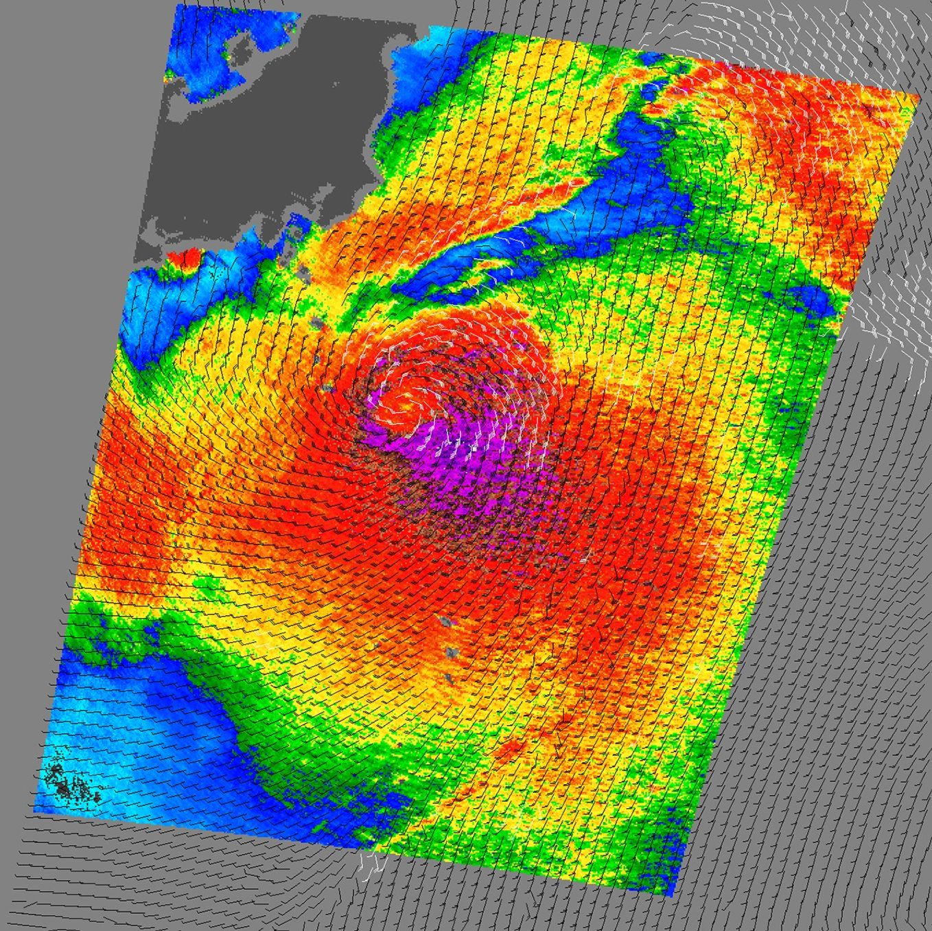
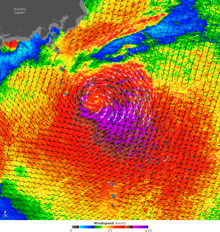
Dujuan was never a strong storm system, and it was quickly fading as it moved north parallel to the east coast of Japan on September 8, 2009. This image shows the wind structure inside the storm as observed by the QuiSCAT satellite on September 8. The strongest winds are purple, while weaker winds are green and blue. The wind direction is shown with black and white barbs. THe white barbs indicate heavy rain. Though Dujuan had a broad field of strong wind (red) surrounding a stronger center, it lacked the distinctly defined circular bands of clouds and winds that are often seen in well-organized storms. (See Hurricane Felicia for an example.) According to the Joint Typhoon Warning Center, Dujuan was transitioning into an extratropical storm system as it moved northeast over cooler water.
References & Resources
NASA image courtesy of David Long, Brigham Young University, on the QuikSCAT Science Team , and the Jet Propulsion Laboratory. Caption by Michon Scott.