


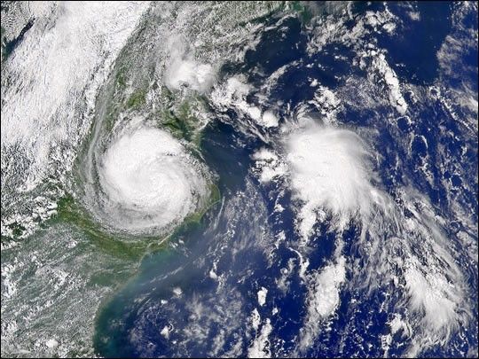
As Tropical Storm Gaston moved over North Carolina and Virginia, Tropical Depression Hermine spun immediately offshore on August 30, 2004, when the Sea-viewing Wide Field-of-view Sensor (SeaWiFS) captured this image. Gaston moved ashore over South Carolina on August 29, and weakened into a depression as it moved north through North Carolina and Virginia. Its maximum winds were about 65 kilometers per hour (40 mph), though it brought heavy rain and flooding to central Virginia. After this image was taken, the storm moved back out over the Atlantic and re-strengthened into a tropical storm.
Meanwhile, Tropical Depression Hermine formed in the North Atlantic on August 29. When this image was taken at 1:45 p.m. Eastern Daylight Savings Time, Hermine had winds of 74 kilometers per hour (46 mph). On August 31, Hermine moved ashore over Massachusetts, but was expected to return to sea.
References & Resources
Image provided by the SeaWiFS Project, NASA/Goddard Space Flight Center, and ORBIMAGE


