


November 8, 2009
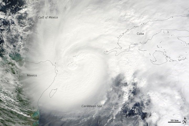
Tropical Storm Ida was poised over the Yucatan Channel between the Caribbean Sea and the Gulf of Mexico when the Moderate Resolution Imaging Spectroradiometer (MODIS) on NASA’s Terra satellite captured this natural-color image of the storm on November 8, 2009. A core of thunderstorms appears near the center of storm, their “boiling” tops contrasting with the smoother deck of clouds that stretches from the Yucatan Peninsula of Mexico eastward to Cuba.
References & Resources
NASA image by Jeff Schmaltz, MODIS Rapid Response Team. Caption by Rebecca Lindsey, NASA Earth Observatory.


