![Request for Information – Potential [Placeholder for Prize]](https://assets.science.nasa.gov/dynamicimage/assets/science/psd/solar/2023/09/s/solarsystem_0.jpg?w=1024)


September 3, 2008
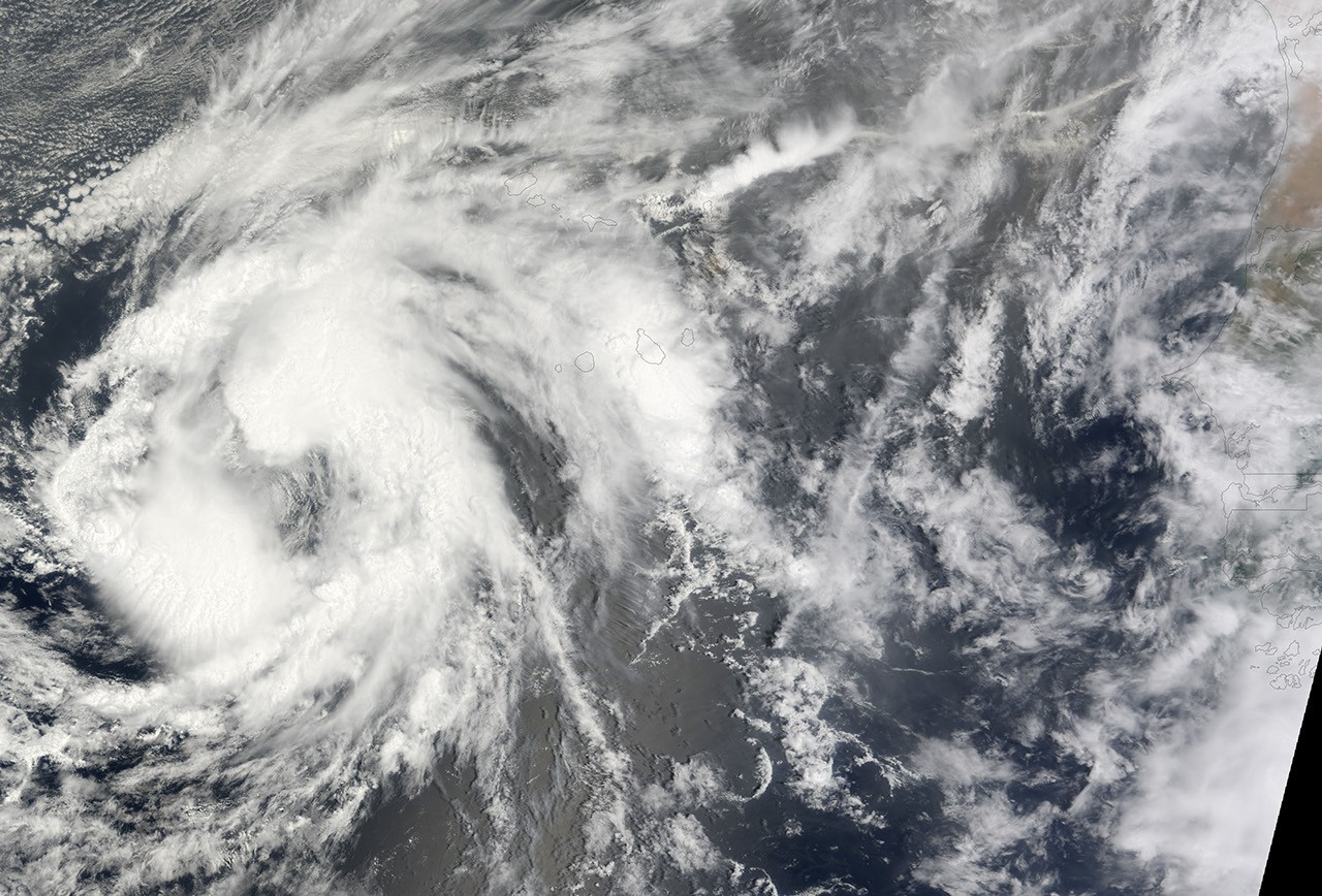
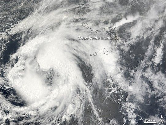
The outer bands of Tropical Storm Josephine cover the Cape Verde Islands off the west coast of Africa in this photo-like image captured on September 4, 2008. The Moderate Resolution Imaging Spectroradiometer (MODIS) on NASA’s Terra satellite captured the image at 11:20 a.m. local time (12:20 UTC). At that time, the storm had winds estimated between 83 and 93 km/hr (52 and 58 mph, or 45 and 50 knots). The weak storm consists of loose bands of clouds roughly arranged in a circular shape in this image. Josephine was forecast to weaken slightly as it moved west across the Atlantic Ocean.
References & Resources
- References
- National Hurricane Center. (2008, September 4). Tropical Storm Josephine. NOAA National Weather Service. Accessed September 4, 2008.
NASA image created by Jesse Allen, using data provided courtesy of the MODIS Rapid Response team. Caption by Holli Riebeek.