


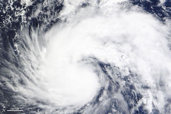
On October 27, 2009, Tropical Storm Mirinae packed sustained winds of 45 knots (85 kilometers per hour) and gusts up to 55 knots (100 kilometers per hour) as it hovered over the Pacific Ocean some 205 nautical miles (380 kilometers) northwest of Guam. The U.S. Navy’s Joint Typhoon Warning Center forecast that the storm would strengthen to a typhoon while traveling in the general direction of the Philippines and Southeast Asia over the next several days.
The Moderate Resolution Imaging Spectroradiometer (MODIS) on NASA’s Terra satellite captured this true-color image of Tropical Storm Mirinae at 11:15 a.m. Manila Time (01:15 UTC) on October 27, 2009. Mirinae has an oblong shape spanning several hundred kilometers, and the storm extends a long arm toward the east.
References & Resources
- Joint Typhoon Warning Center. (2009, October 27). Tropical Storm 23W (Mirinae) Warning #07. Accessed October 27, 2009.
NASA image courtesy MODIS Rapid Response Team. Caption by Michon Scott.