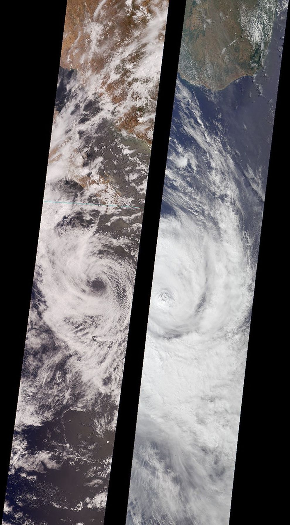

















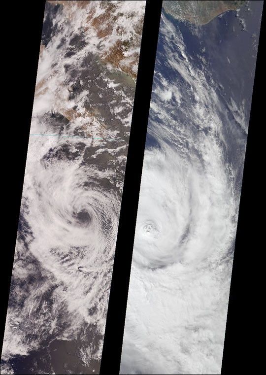
Like dancers pirouetting in opposite directions, the rotationalpatterns of two different tropical storms are contrasted in this pair ofMulti-angle Imaging Spectroradiometer (MISR) nadir-camera images.
The left-hand image is of Tropical Storm Bud, acquired on June17, 2000 (Terra orbit 2656) as the storm was dissipating. Bud wassituated in the eastern Pacific Ocean between Socorro Island and thesouthern tip of Baja California. South of the storm’s center is a vortex pattern caused byobstruction of the prevailing flow by tiny Socorro Island. Sonora,Mexico and Baja California are visible at the top of the image.
The right-hand image is of Tropical Cyclone Dera, acquired onMarch 12, 2001. Dera was located in the Indian Ocean,south of Madagascar. The southern end of this large island is visible inthe top portion of this image.
Northern hemisphere tropical storms, like Bud, rotate in acounterclockwise direction, whereas those in the southern hemisphere,such as Dera, rotate clockwise. The opposite spins are a consequence ofEarth’s rotation.
Each image covers a swath approximately 380 kilometers wide.
References & Resources
Image courtesy NASA/JPL/GSFC/LaRC, MISR Team