![Request for Information – Potential [Placeholder for Prize]](https://assets.science.nasa.gov/dynamicimage/assets/science/missions/a-step/FFR_Earth_Background_20251120%20.png?w=1024)


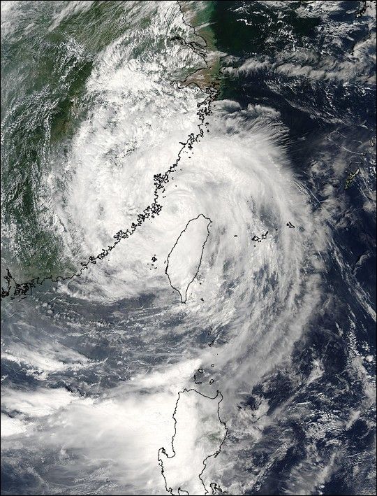
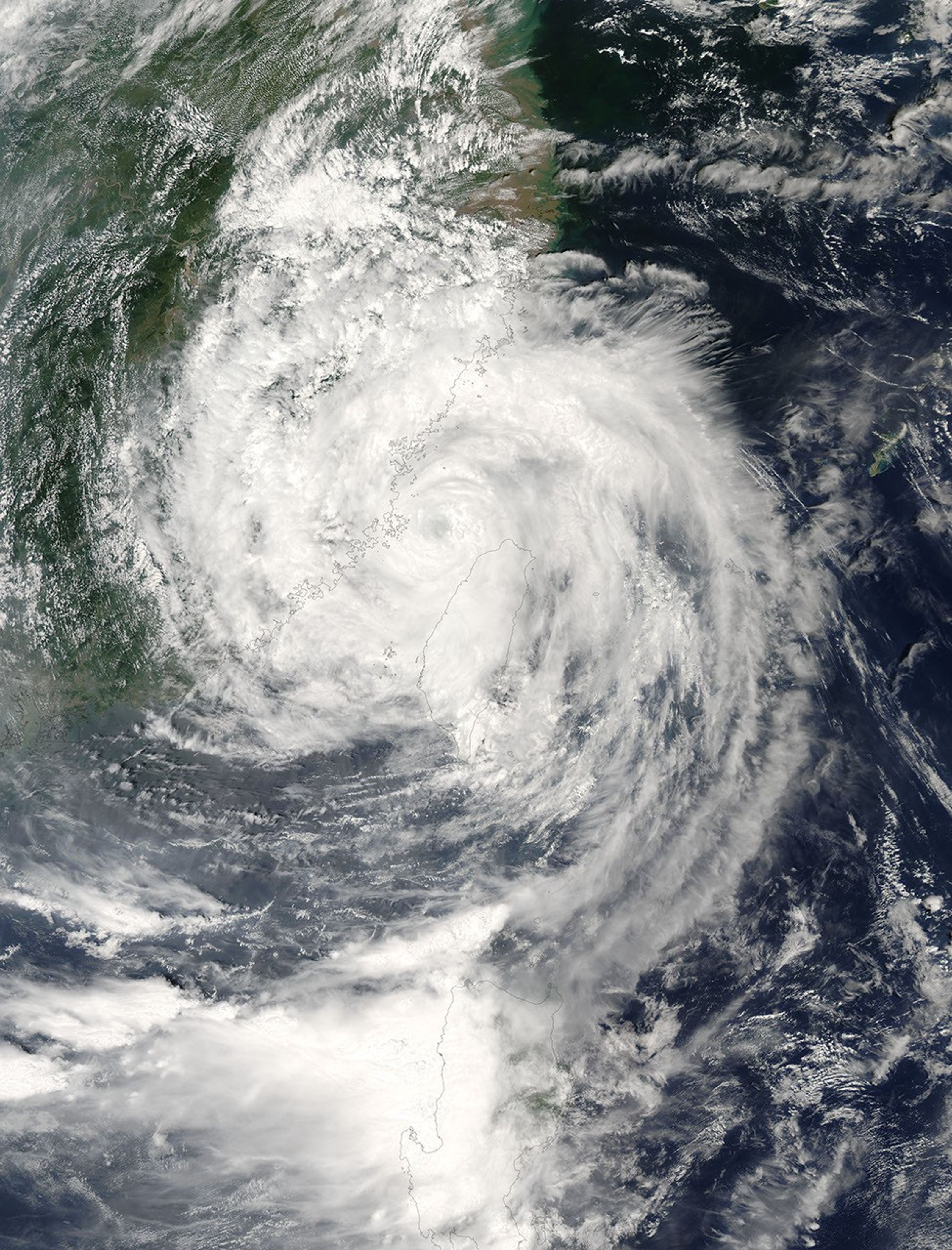
The MODIS instrument aboard NASA's Aqua satellite captured this true-color image of Typhoon Aere on August 25, 2004 at 5:20 UTC. At the time this image was taken Aere was located about 130 km (81 miles) northwest of Taipei, Taiwan and was moving towards the west at 17 km/hr (10 mph). Maximum sustained winds were near 143 km/hr (89 mph) with higher gusts to 167 km/hr (104 mph).
Aere made landfall on southeast China's Fujian province at 8:30 UTC and was expected to also strike Zhejiang province, an area that is still mopping up after Typhoon Rananim left 164 people dead and 1,800 injured just weeks ago.
The MODIS Rapid Response System provides this image at additional resolutions and formats.
References & Resources
NASA image courtesy Jacques Descloitres, MODIS Land Rapid Response Team at NASA GSFC.