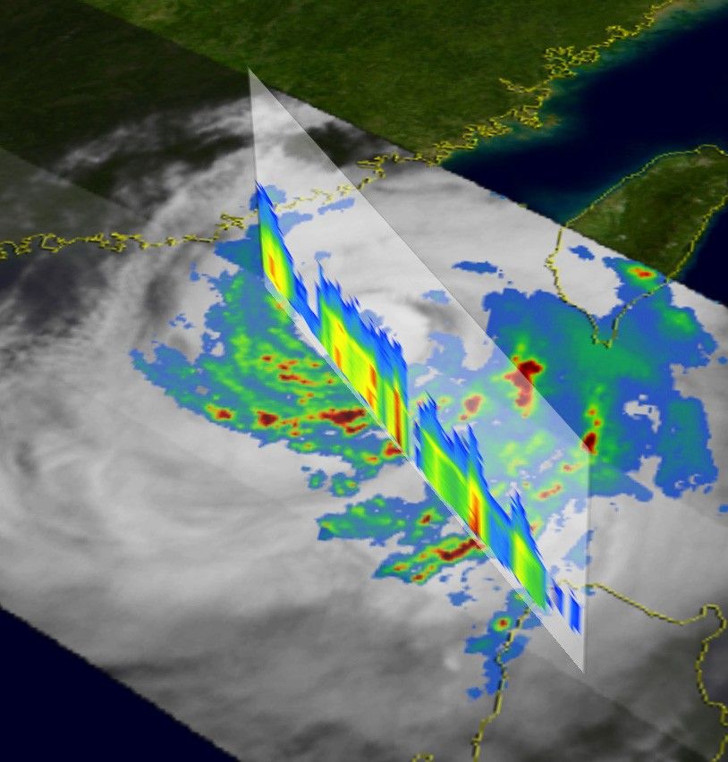
The Tropical Rainfall Measuring Mission (TRMM) satellite captured thisimage of Typhoon Dujuan just after it had brushed the southern tip ofTaiwan where it was responsible for two fatalities. The image was taken at22:33 UTC on September 1, 2003. At the time, Dujuan was stillclassified as a powerful Category 4 storm with winds estimated at near135 mph and was moving west-north-west towards the coast of China. Theimage gives a top down view of the storm. Rainfall rates from the TRMMMicrowave Imager (TMI) are overlayed on TRMM Visible Infrared Scanner(VIRS) data (white areas). It shows that all of the deep convection andheavy rain rates (darker red areas) that are responsible for providingthe heat energy needed to the fuel the storm are present only in theouter rain bands on the south and east sides of the storm. Susequently,Dujuan began to weaken as it approached the coast of China.
TRMM is a joint mission between NASA and the Japanese space agency, NASDA.
References & Resources
Images produced by Hal Pierce (SSAI/NASA GSFC) and caption by Steve Lang (SSAI/NASA GSFC)