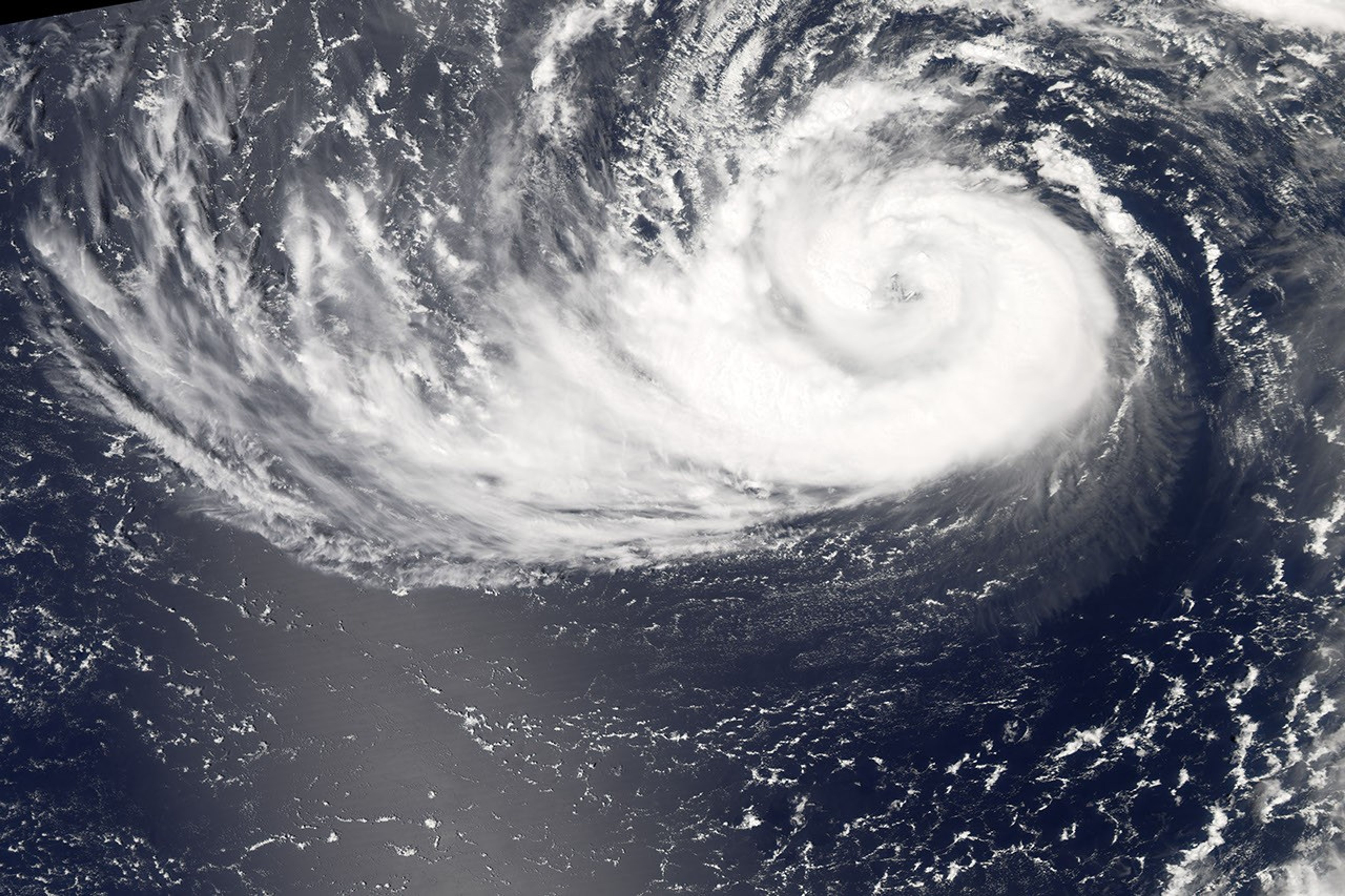
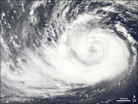
Typhoon Fitow formed in the western Pacific and gradually built power, reaching typhoon status on August 29, 2007. As of August 31, the forecasted storm track called for Fitow to head towards Japan, with the outer edges of the storm reaching the Honshu coastline by September 5. The typhoon was also predicted to continue to climb in power as it approached the islands, possible reaching Category 3 strength prior to landfall.
The Moderate Resolution Imaging Spectroradiometer (MODIS) on NASA’s Aqua satellite acquired this photo-like image at 1:10 p.m. local time (3:10 UTC) on August 31, 2007. Just a few hours before MODIS observed the storm, the Joint Typhoon Warning Center estimated Fitow’s sustained winds to be over 130 kilometers per hour (80 miles per hour). The satellite image shows Fitow to have spiraling clouds and towering thunderstorms near the center, which are characteristic of powerful tropical storm systems. The eye of the storm is well defined, another characteristic of strong storms. However, a long, sprawling arm of the storm reaches out far to the west; when storms are very powerful, they are usually tightly wound and more symmetrically shaped.
You can download a 250-meter-resolution KMZ file of Typhoon Fitow suitable for use with Google Earth.
References & Resources
NASA image created by Jesse Allen, using data provided courtesy of the MODIS Rapid Response team.