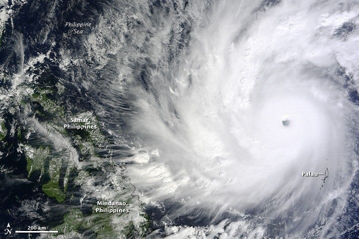
The twenty-second tropical weather system (and eleventh typhoon) of the year in the Western Pacific Ocean had the potential to be one of the most damaging of 2014. In early December, Hagupit approached The Philippines as a major and slow-moving typhoon that threatened to hit the islands with torrential rain and a large storm surge. Hundreds of thousands of people were evacuated in the lead-up to the storm on December 5.
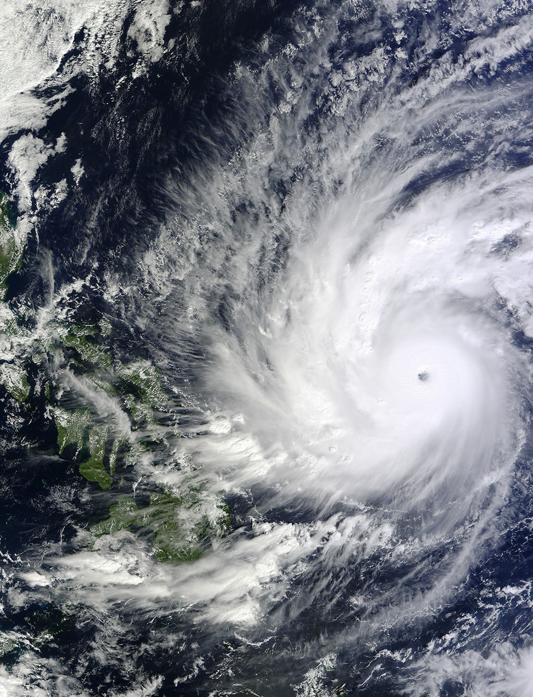
The Moderate Resolution Imaging Spectroradiometer (MODIS) on NASA’s Terra satellite acquired this image at 11:20 a.m. Palau time (0210 Universal Time) on December 4, 2014. At the time, Hagupit was a category 5 super typhoon with sustained winds of 155 knots (180 miles or 290 kilometers per hour). It was the fourth category 5 typhoon of the year in the Western Pacific.
As of 2 a.m. Philippine Time (1800 Universal Time) on December 5, 2014, the U.S. Joint Typhoon Warning Center (JTWC) observed wind speeds of 130 knots (150 mph or 240 kmph) and significant wave heights of 45 feet over the Pacific Ocean. JTWC forecasted that the eye of the storm could reach Samar Island overnight on December 6-7. Samar was severely damaged in November 2013 by Super Typhoon Haiyan. The Philippines National Disaster Risk Reduction and Management Council predicted rainfall rates as high as 20 millimeters (0.8 inches) per hour and a storm surge of 4.5 meters (15 feet).
Note: MODIS did not acquire images of Hagupit on December 5 because the storm fell right under an equatorial gap in the satellite’s field of view.
References & Resources
- Jeff Masters’ WunderBlog, via Weather Underground (2014, December 5) Super Typhoon Hagupit Closes in on the Philippines. Accessed December 5, 2014.
- NASA Hurricane Page (2014, December 5) Hagupit. Accessed December 5, 2014.
- Philippines National Disaster Risk Reduction and Management Council (2014, December 5) Severe Weather Bulletin for Typhoon “Ruby” (Hagupit) Accessed December 5, 2014.
- Unisys Weather (2014) 2014 Hurricane/Tropical Data for Western Pacific. Accessed December 5, 2014.
NASA image by Jeff Schmaltz, LANCE/EOSDIS Rapid Response. Caption by Mike Carlowicz.