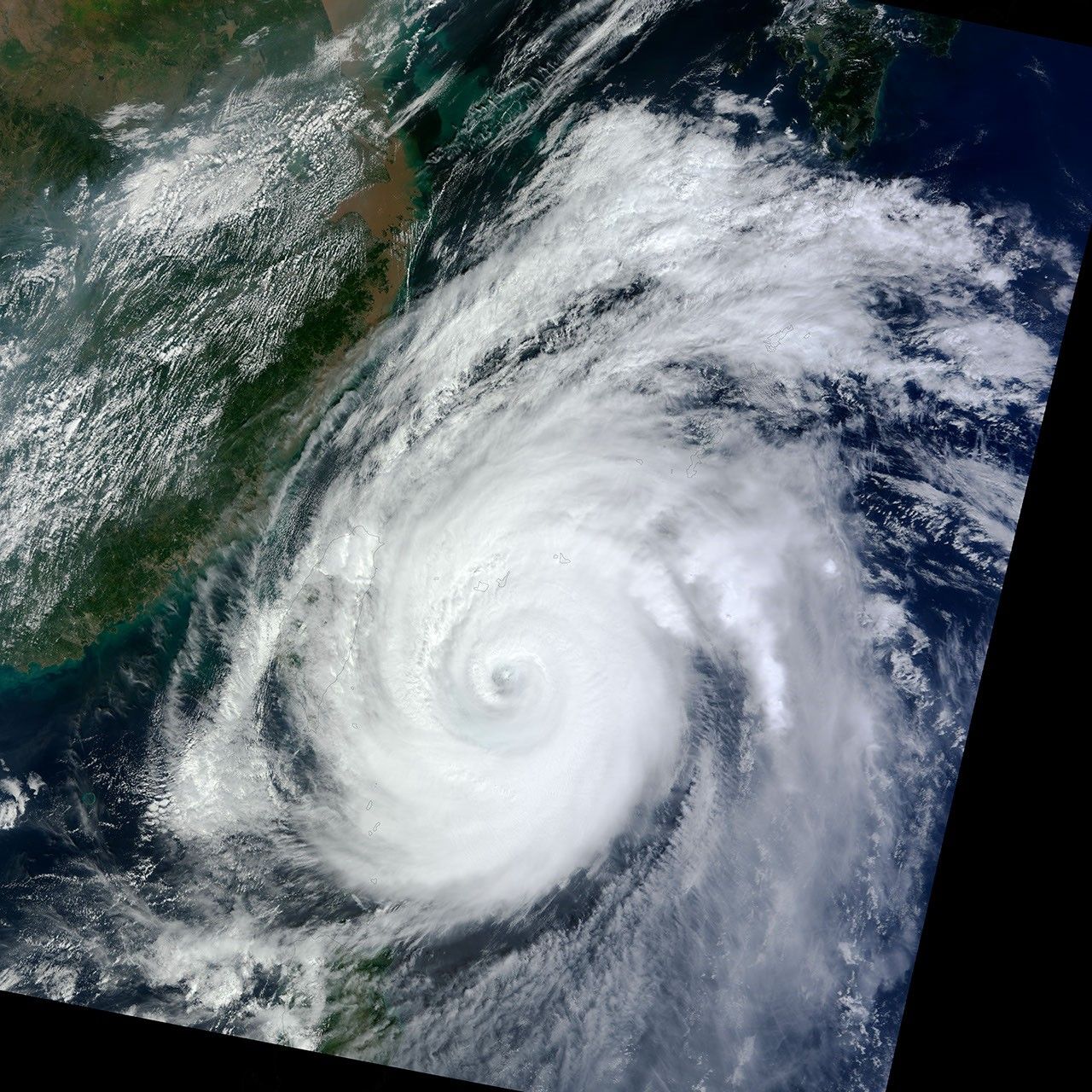
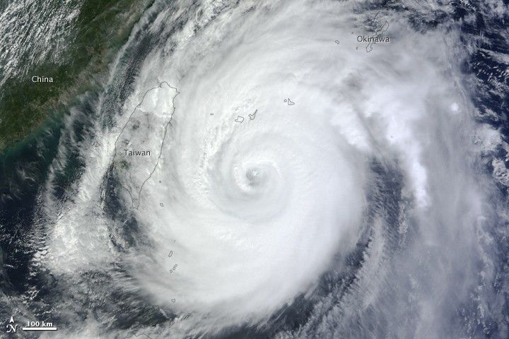
Typhoon Jelawat was bearing down on Okinawa on September 28, 2012, with mainland Japan lurking in its future. Forecasts called for the eye of the storm to pass over or close to Okinawa as a category 2 or 3 typhoon on September 29. Jelawat was predicted to approach Japan’s main island of Honshu as a category 1 typhoon or tropical storm late on September 30.
The Moderate Resolution Imaging Spectroradiometer (MODIS) on NASA’s Terra satellite captured this image of Jelawat on September 28, 2012. The typhoon brushed within 200 miles of the coast of Taiwan, but did not inflict significant damage.
At 21:00 Universal Time on September 28 (6 a.m. Japan Standard Time on September 29), the U.S. Navy’s Joint Typhoon Warning Center (JTWC) reported maximum significant wave heights of 12 meters (39 feet), sustained winds of 194 kilometers (120 miles) per hour, and gusts up to 240 kilometers (149 miles) per hour. The typhoon was centered at 25.5° North latitude, 126.5° East longitude, about 200 kilometers (125 miles) southwest of Kadena Air Base in Okinawa, Japan.
Jelawat formed on September 20 and reached “super typhoon” status—maximum sustained winds above 240 kilometers (150 miles) per hour—by September 24. University of Miami meteorologist Brian McNoldy wrote: “Jelawat became the second super typhoon to pass over the region in two weeks: Sanba was just there on September 13-14. While the western Pacific is no stranger to frequent typhoons, it is quite rare to have two consecutive super typhoons.”
The typhoon has weakened as it has moved northward, but it still poses a formidable threat to island and coastal communities.
References & Resources
- Japan Meteorological Agency (2012, September 28) Tropical Cyclone Information. Accessed September 28, 2012.
- Joint Typhoon Warning Center (2012, September 28) Super Typhoon 18W (Jelawat) Warning. Accessed September 28, 2012.
- The Washington Post (2012, September 28) Capital Weather Gang: Typhoon Jelawat closing in on Okinawa, Japan. Accessed September 28, 2012.
- Weather Underground (2012, September 28) Dr. Jeff Masters WunderBlog: A Jelawat mystery. Accessed September 28, 2012.
NASA Earth Observatory image by Jesse Allen, using data from the Land Atmosphere Near real-time Capability for EOS (LANCE). Caption by Michael Carlowicz.