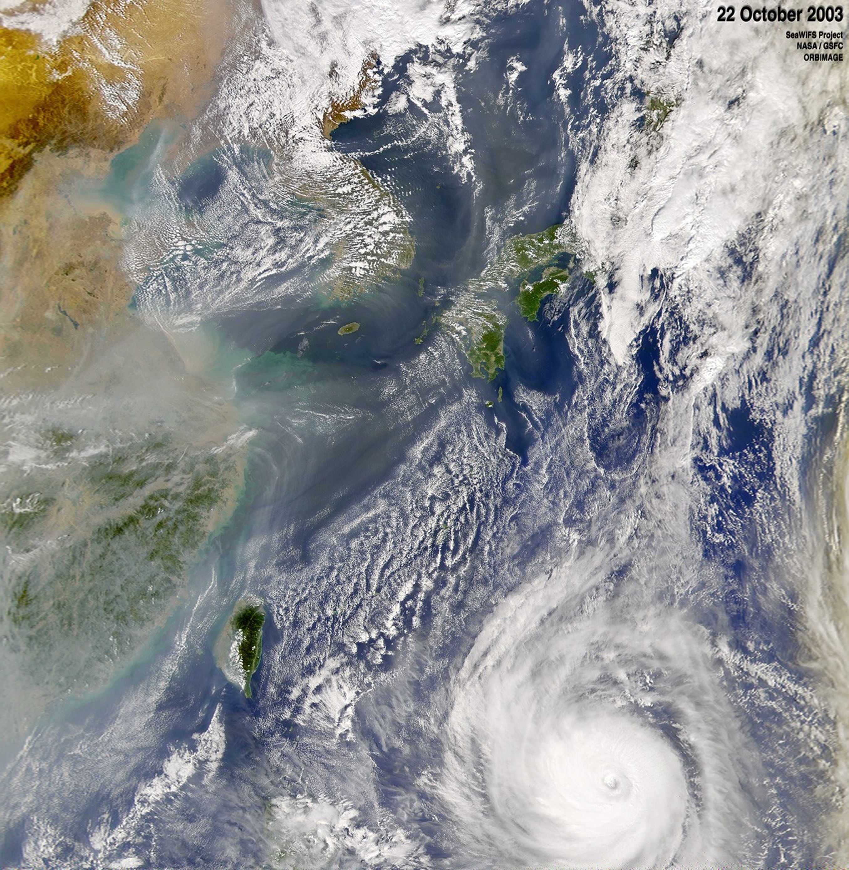
Suggested Searches

1 min read

Typhoon Ketsana

Instruments:
2003-10-22 00:00:00
October 22, 2003

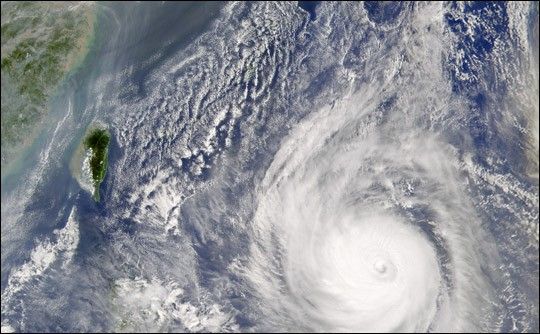
Typhoon Ketsana moves through the western Pacific Ocean. In this image, recorded by the Sea-viewing Wide Field-of-view Sensor (SeaWiFS)on October 22, 2003, the storm is about 600 kilometers southeast of Taiwan. Ketsana continues to maintain 144 mile per hour winds with higher gusts.

References & Resources

Image courtesy the SeaWiFS Project, NASA/Goddard Space Flight Center, and ORBIMAGE

You may also be interested in:

Stay up-to-date with the latest content from NASA as we explore the universe and discover more about our home planet.

Ragasa Steers Toward China
3 min read

The super typhoon headed for Guangdong province after lashing Taiwan and northern Luzon in the Philippines.

Article
Typhoon Kajiki Lashes Southeast Asia
2 min read

Late summer in the Northwest Pacific Ocean often sees an increase in storminess, which in August 2025 included a typhoon…

Article
A Subtle Return of La Niña 
3 min read

A weak La Niña emerged in the equatorial Pacific in late 2025, and scientists are watching how it may help…

Article