
Compared to the hurricane season in the Atlantic Basin, 2017 has been a relatively mild year in the western Pacific Ocean, which is typically the most active basin in the world. Since the beginning of January, eight tropical systems have reached typhoon strength, and just one became a super typhoon. Lan might break that pattern.
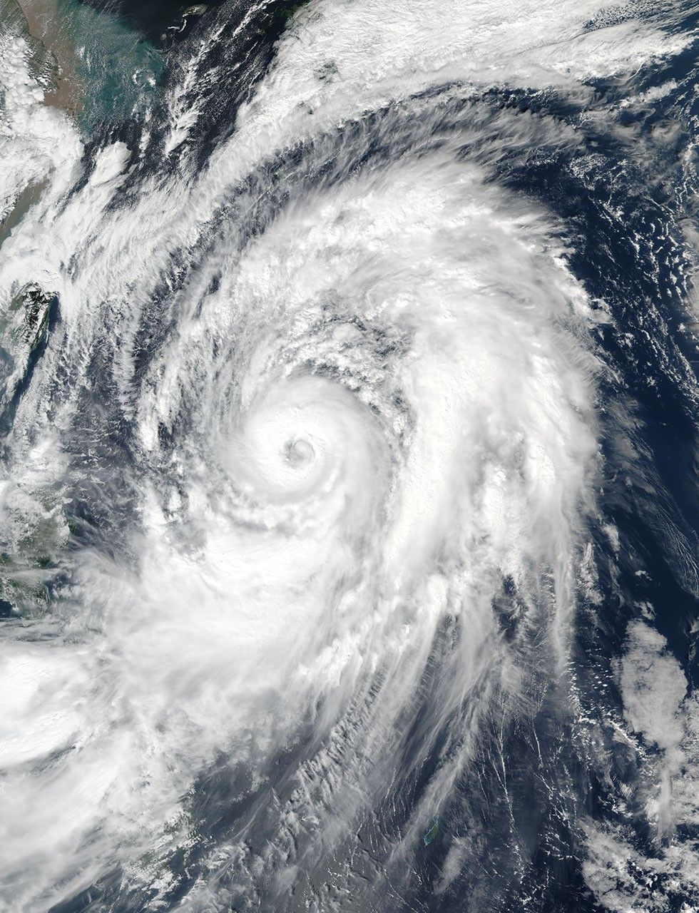
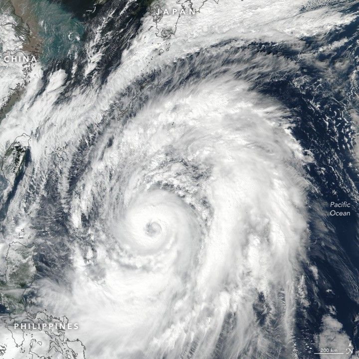
On October 20, 2017, the Visible Infrared Imaging Radiometer Suite (VIIRS) on Suomi NPP acquired this natural-color image of Typhoon Lan in the western Pacific. Around that time, the storm was reported to have maximum sustained winds of 90 knots (105 miles or 165 kilometers per hour), a category-2 typhoon. The eye of the storm was estimated to be 80 kilometers (50 miles) wide. Though the storm was headed on a northward track, its outer bands reached as far as Taiwan and the Philippines.
With Lan churning over warm water, and with upper level winds staying relatively calm, forecasters believe the storm could undergo rapid intensification and reach category 4 strength on October 20 or 21. The storm is expected to pass east of Okinawa on October 22 and make a possible landfall near Tokyo on October 22 or 23. The Japan Meteorological Agency placed all prefectures along Japan’s east coast under an advisory for gale force winds and high waves. Some areas were also under an advisory for storm surge.
References & Resources
- Joint Typhoon Warning Center (2017) JTWC Tropical Warnings. Accessed October 20, 2017.
- Reuters, via The Japan Times (2017, October 20) Typhoon Lan on course to hinder voting as it approaches Okinawa. Accessed October 20, 2017.
- Unisys Weather (2017) 2017 Hurricane/Tropical Data for Western Pacific. Accessed October 20, 2017.
- The Washington Post (2017, October 20) Typhoon Lan rapidly intensifies in Pacific on its path toward Japan. Accessed October 20, 2017.
- Weather Underground (2017, October 20) Intensifying Typhoon Lan Will Brush Okinawa This Weekend, Then Hammer Japan with Flooding Rain, High Winds. Accessed October 20, 2017.
NASA image by Jeff Schmaltz, LANCE/EOSDIS Rapid Response. Story by Mike Carlowicz.