


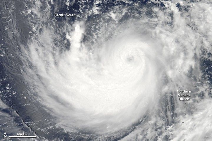
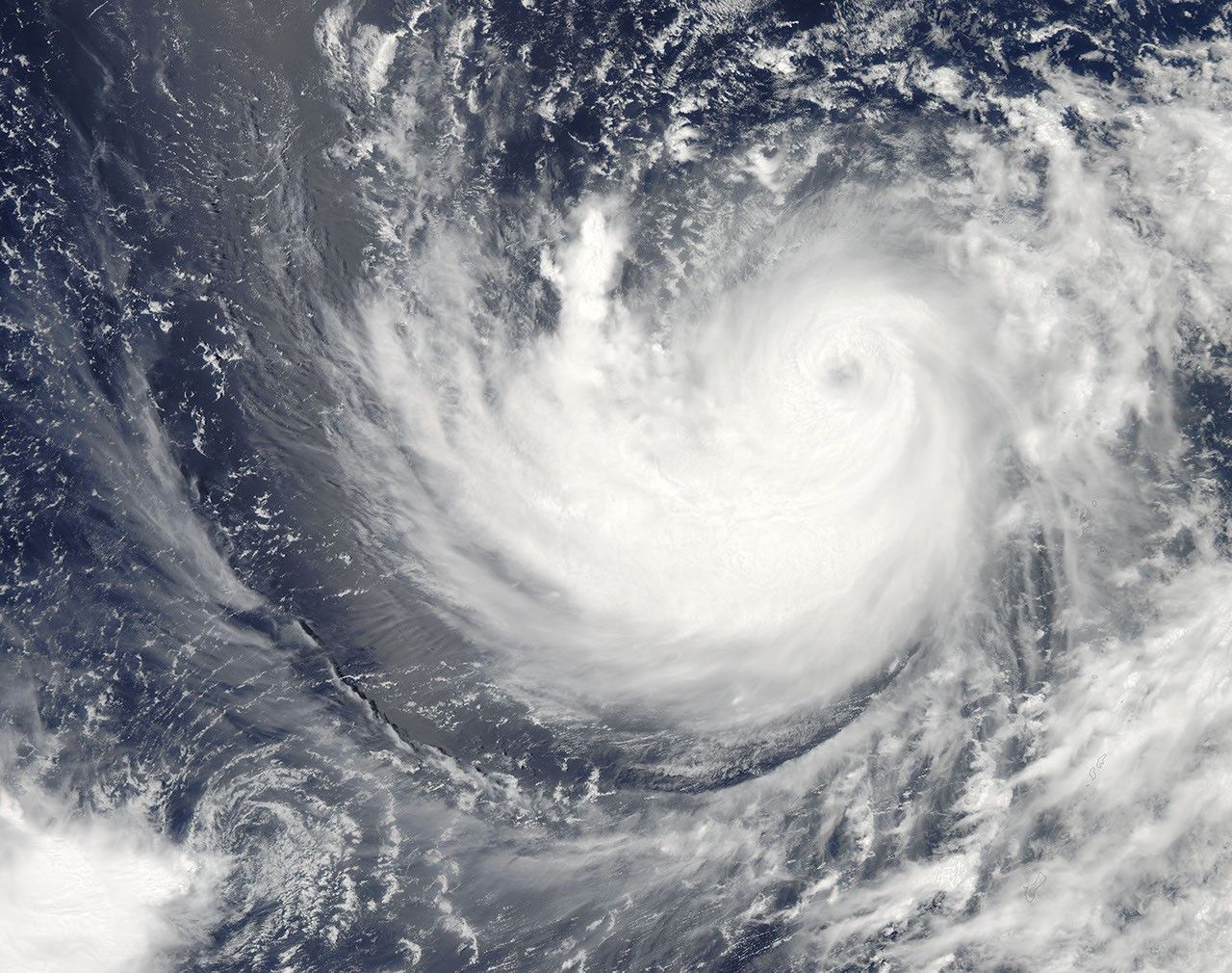
In mid-July 2011, the eighth tropical storm of the Pacific storm season rapidly intensified and was officially declared Typhoon Ma-on. Bands of the typhoon sent soaking rain across Guam, the Mariana Islands, and other tropical Pacific locations. The storm appeared to be headed toward Okinawa and then the disaster-ravaged Japanese mainland, forecasts suggested.
The Moderate Resolution Imaging Spectroradiometer (MODIS) on NASA’s Aqua satellite acquired this image on July 15, 2011. At 15:00 Universal Time on July 15, the typhoon was centered approximately 270 nautical miles (500 kilometers) south-southeast of Iwo To, Japan, and moving west at 12.6 miles per hour (20 kilometers per hour, 11 knots). The typhoon packed sustained winds of 132 miles per hour (213 kilometers per hour, or 115 knots), with gusts to 161 miles per hour (259 kilometers per hour, or 140 knots).
Forecasters from the U.S. Joint Typhoon Warning Center (JTWC) indicated a landfall in Japan was possible on July 19 or 20, based on current estimates of conditions. JTWC cautioned that the storm is not likely to weaken until it makes landfall or moves into higher latitudes.
References & Resources
- References
- NASA (n.d.) Hurricane/Tropical Cyclone Resource Page. Accessed July 15, 2011.
- The Washington Post (2011, July 13) Capital Weather Gang: Typhoon Ma-on poses new threat to Japan. Accessed July 15, 2011.
- U.S. Joint Typhoon Warning Center (n.d.) Current Northwest Pacific/North Indian Ocean Tropical Systems. Accessed July 15, 2011.
NASA image courtesy Jeff Schmaltz, MODIS Rapid Response Team. Caption by Mike Carlowicz.


