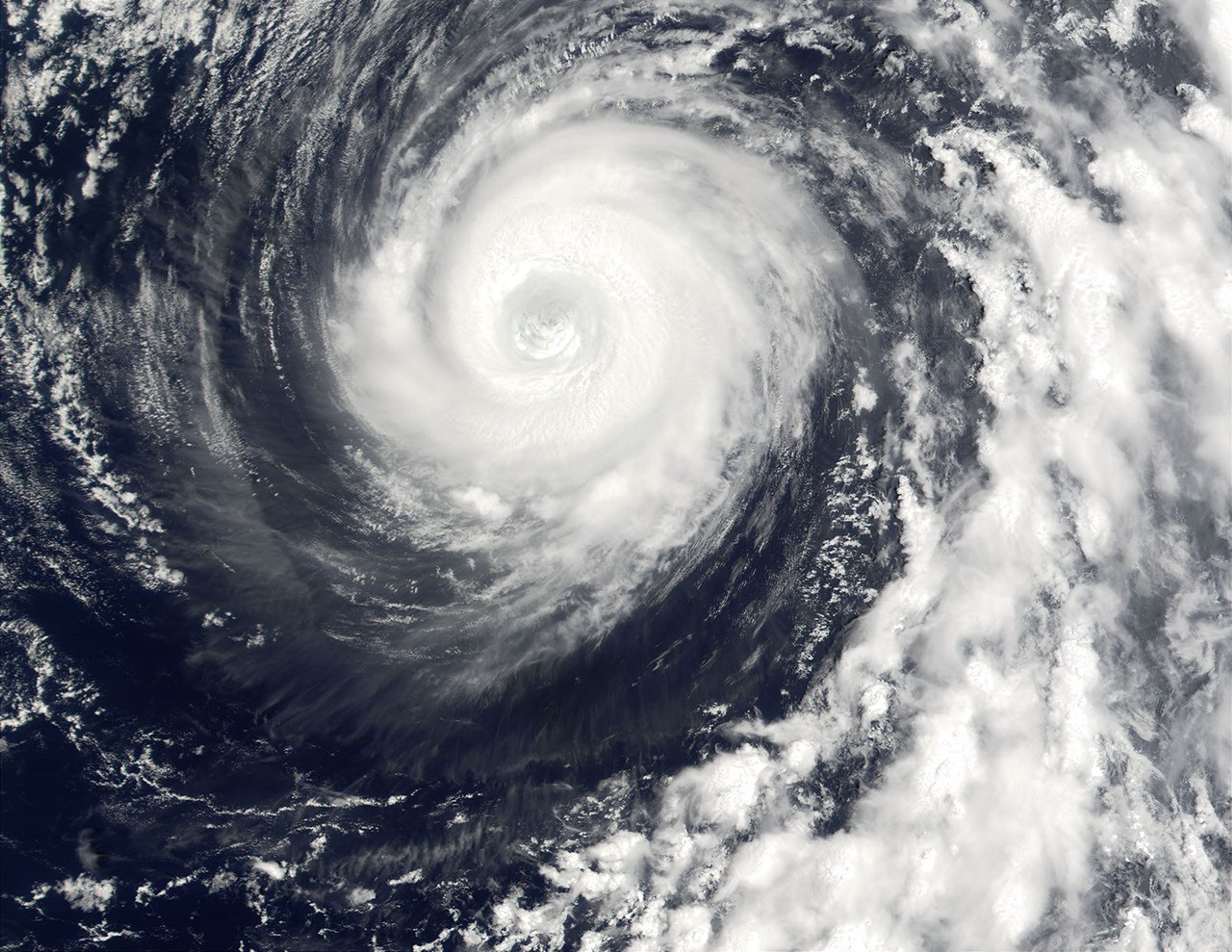

This true-color Moderate-resolution Imaging Spectroradiometer (MODIS) image shows Typhoon Man-Yi on Aug. 6, 2001, spinning in the Pacific Ocean just east of the Bonin Islands and northeast of Iwo Jima. In this scene, the eye of the storm is located about 1,000 km (620 miles) southeast of Japan's main island of Honshu. Typhoon Man-Yi passed directly over the Mariana Islands on Aug. 4.
At the time this image was acquired, Typhoon Man-Yi was packing a powerful punch, with sustained winds of 213 km per hour (132 miles per hour) and wind gusts of up to 259 km per hour (160 miles per hour). The storm was moving northeastward at about 4 knots.
MODIS flies aboard NASA's Terra satellite.
References & Resources
Image courtesy Jacques Descloitres, MODIS Land Rapid Response Team at NASA GSFC