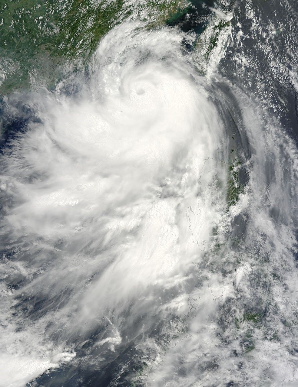


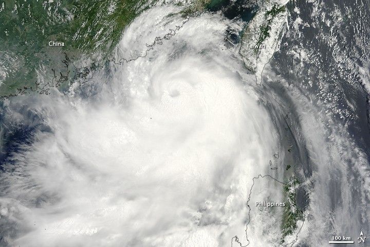
Typhoon Molave was building from a tropical storm into a typhoon on the morning of July 18, 2009, when the Moderate Resolution Imaging Spectroradiometer (MODIS) on NASA’s Terra satellite captured this photo-like image. Though still a tropical storm, Molave’s shape is distinctive in this image. Clouds swirl around a dark depression, which marks the eye of the storm.
According to the Joint Typhoon Warning Center, the storm’s maximum sustained winds were between 55 and 60 knots (100-110 kilometers per hour or 63 -70 miles per hour). Later in the day, Molave became a Category 1 typhoon with winds of 65 knots (120 km/hr or 75 mph. It weakened before coming ashore over China on July 19.
References & Resources
- Unisys Weather. (2009, July 19). Typhoon-1 Molave. Accessed July 20, 2009.
NASA image by Jeff Schmaltz, MODIS Rapid Response Team, Goddard Space Flight Center.