


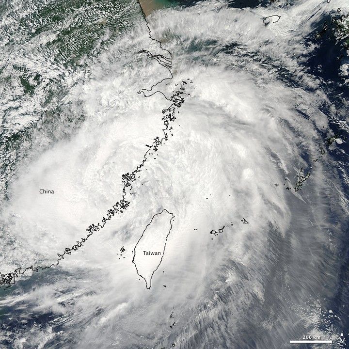
Weakened after crossing the mountainous island of Taiwan, Typhoon Morakot moved ashore over southern China on August 9, 2009. This image, captured by the Moderate Resolution Imaging Spectroradiometer (MODIS) on NASA’s Aqua satellite at 1:15 p.m., local time (5:15 UTC) on August 9, shows the center of the storm coming ashore over China. Morakot exhibits a loose spiral shape without the distinctive bands of clouds or eye evident in stronger storms.
At the time this image was taken, Morakot had winds of about 75 kilometers per hour (45 miles per hour or 40 knots). More damaging, however, was the storm’s intense rain. Morakot moved slowly over Taiwan, releasing a torrent of rain over the island that lasted several days. Southern Taiwan recorded a record 8 feet (244 centimeters) of rain, reported the New York Times. The rain caused flooding and landslides, one of which buried a village in Taiwan. As of August 10, thirty-seven people had been reported dead in the Philippines, Taiwan, and China, not including those affected by the landslide said the New York Times.
The large image provided above is at MODIS’ full resolution of 250 meters per pixel. The image is available in additional resolutions from the MODIS Rapid Response Team.
References & Resources
- 2009 Hurricane/Tropical Data for Western Pacific. (2009, August 7). Typhoon Morakot. Unisys Weather. Accessed August 10, 2009.
- Wines, M. (2009, August 10). Death toll rises as typhoons pummel Asia. New York Times. Accessed August 10, 2009.
NASA image courtesy the MODIS Rapid Response Team at NASA GSFC. Caption by Holli Riebeek.


