Though its wind speeds were not impressive compared to many typhoons, Nangka caused great concern for Japanese authorities on July 16, 2015. The typhoon was slow-moving, a characteristic that tends to produce the highest rainfall totals and allows for large storm surge waves to build up. The Japanese Meteorological Agency was calling for as much as 800 millimeters (nearly 3 feet) of rain in portions of the rugged, mountainous regions of southwestern Japan.
The storm made landfall near Muroto City on the Japanese island of Shikoku around 11 p.m. Japan Standard Time (14:00 Universal Time) on July 16. In the lead-up to the storm, the government advised nearly 4,000 residents of Kochi Prefecture to evacuate their homes for fear of landslides.
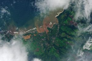
The Moderate Resolution Imaging Spectroradiometer (MODIS) on NASA’s Terra satellite acquired this natural-color image of Typhoon Nangka at 02:05 Universal Time (11:05 a.m. JST) on July 16, 2015. Shortly before the image was acquired, Nangka was a category 1 storm with maximum sustained winds of about 130 kilometers (80 miles) per hour, according to Unisys Weather.
Weather blogger Bob Henson of Weather Underground reported that estimated rainfall rates approached 75 millimeters (3 inches) per hour in the early hours after landfall. “A total of 521 millimeters (20.51 inches) had fallen by late Thursday at the village of Kamikitayama, south of Osaka,” Henson wrote.
The storm had a long evolution, becoming a typhoon on July 4 and traveling nearly 4,000 kilometers across the Pacific Ocean. One week before its arrival in Japan (July 9), the storm had maximum sustained winds of 250 kilometers per hour (155 miles per hour). On July 13, infrared and microwave imagery, revealed a double-eyewall structure that often leads to an decrease in intensity, according to a blog post by the Cooperative Institute for Meteorological Satellite Studies. The storm then weakened as it turned north toward Japan.
Click here for a day-long view of the development of Nangka, as observed by Japan’s new Himawari geostationary weather satellite on July 14.
References & Resources
- CIMSS Satellite Blog (2015, July 13) Unusual Double Eyewall Structure in Himawari-8 Infrared Imagery of Typhoon Nangka. Accessed July 16, 2015.
- The Japan Times (2015, July 16) Typhoon Nangka menaces west Japan. Accessed July 16, 2015.
- Joint Typhoon Warning Center (2015) Nangka. Accessed July 16, 2015.
- Unisys Weather (2015) Super Typhoon-4 Nangka. Accessed July 16, 2015.
- The Washington Post, Capital Weather Gang (2015, July 15) After a 4,000-mile trek acros the Pacific Ocean, Typhoon Nangka to batter Japan. Accessed July 16, 2015.
- WunderBlog at WeatherUnderground (2015, July 16) Typhoon Nangka Brings Torrential Rains to Japan. Accessed July 16, 2015.
NASA image courtesy Jeff Schmaltz, LANCE/EOSDIS MODIS Rapid Response Team at NASA GSFC. Caption by Mike Carlowicz and Kathryn Hansen.


