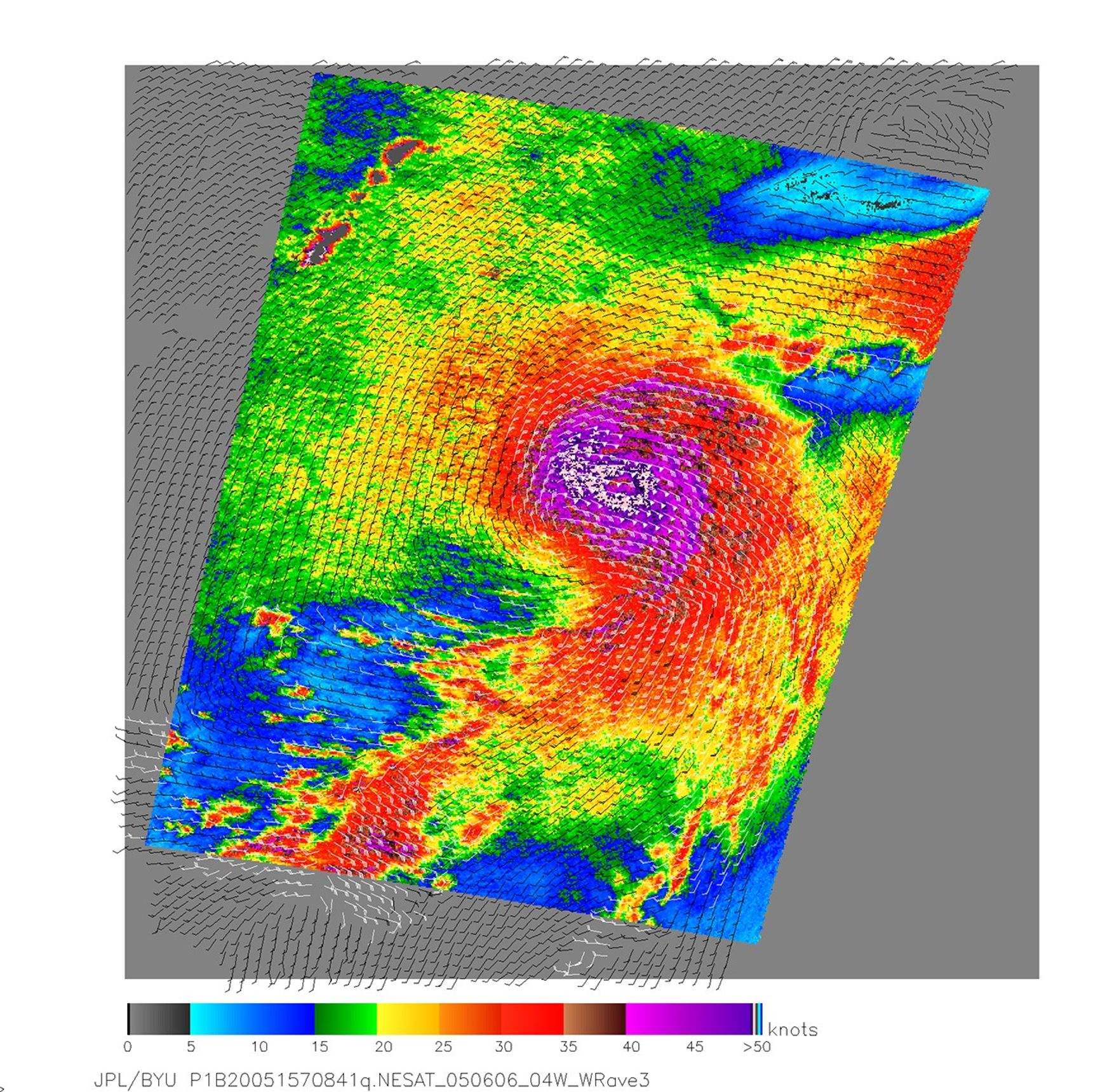
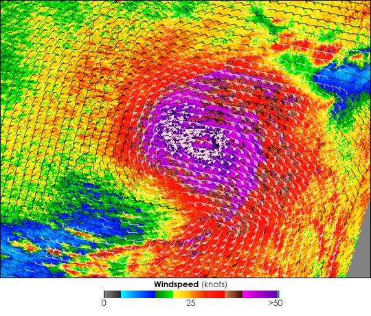
NASA’s QuikSCAT satellite captured this image of Typhoon Nesat on June 6, 2005, at 8:41 UTC. At that time, Nesat had winds of 213 kilometers per hour (115 knots or 132 mph) with gusts to 259 kph (140 knots or 161 mph), making it the equivalent of a Category 4 hurricane. The storm was moving north toward Japan over the Philippine Sea.
This colorful image shows the near-surface winds generated by the storm 10 meters above the ocean. The highest wind speeds, shown in dark purple and light pink, circle the center of the storm with barbs showing the direction of the winds. White barbs near the center of the storm indicate areas of heavy rain.
The scatterometer on the satellite records wind speeds by sending pulses of microwave energy through the atmosphere to the ocean surface, and measuring the energy that bounces back from the wind-roughened surface. The energy of the microwave pulses changes depending on wind speed and direction, giving scientists a way to monitor wind around the world. Generating accurate wind speeds inside a typhoon such as Nesat can be challenging because the unusually heavy rain found in a cyclone distorts the microwave pulses in a number of ways, making a conversion to accurate wind speed difficult. As a result, the wind speeds shown here are lower than wind speeds recorded by the Joint Typhoon Warning Center. Instead, the scatterometer provides a nice picture of the relative wind speeds within the storm and shows wind direction.
References & Resources
NASA image courtesy the QuikSCAT Science Team at the Jet Propulsion Laboratory.