September 16, 2012
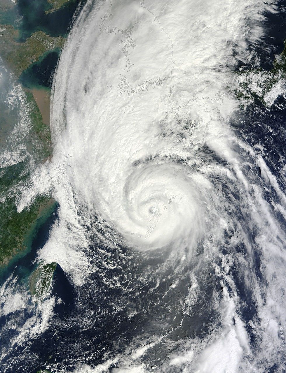
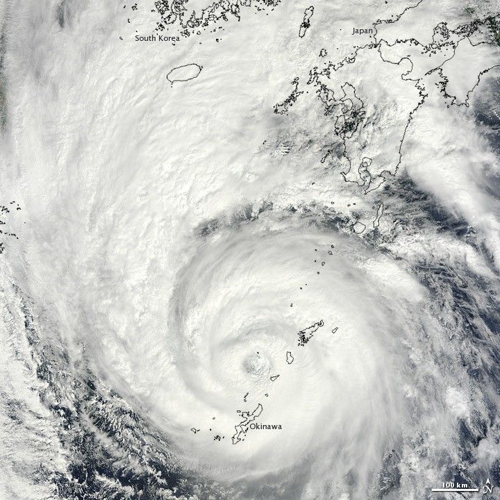
On September 16, 2012, the eye of Typhoon Sanba was located just north of Okinawa, Japan. Sanba was moving toward the Korean Peninsula, and storm clouds already extended over that peninsula. The Moderate Resolution Imaging Spectroradiometer (MODIS) on NASA’s Terra satellite captured this natural-color image the same day.
On September 16, the U.S. Navy’s Joint Typhoon Warning Center reported that Sanba had maximum sustained winds of 90 knots (165 kilometers per hour) and gusts up to 110 knots (205 kilometers per hour). Although wind speeds had declined considerably over the previous few days, Sanba remained a powerful typhoon.
References & Resources
- Joint Typhoon Warning Center. (2012, September 16) Super Typhoon 17W (Sanba) Warning. [Online] URL: http://www.usno.navy.mil/NOOC/nmfc-ph/RSS/jtwc/warnings/wp1712web.txt. Accessed September 16, 2012.
- Unisys Weather. (2012, September 17) Sanba Tracking Information. Accessed September 17, 2012.
NASA image courtesy Jeff Schmaltz, LANCE MODIS Rapid Response Team at NASA GSFC. Caption by Michon Scott.