Suggested Searches

1 min read

Typhoon Songda

Instruments:
2004-09-03 00:00:00
September 3, 2004

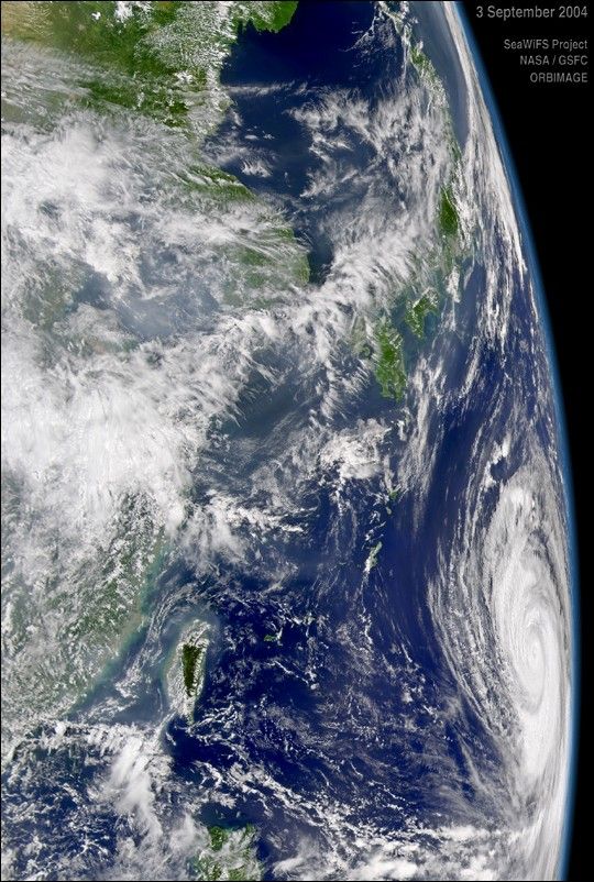
The SeaWiFS instrument aboard the OrbView-2 satellite captured this oblique view of Typhoon Songda on September 3, 2004 at 4:00 UTC. At the time this image was taken Songda was located approximately 834 km (518 miles) east-southeast of Okinawa, Japan and was moving towards the west-northwest at 20 km/hr (13 mph). Maximum sustained winds were near 213 km/hr (132 mph) with gusts to 259 km/hr (161 mph).

References & Resources

Provided by the SeaWiFS Project, NASA/Goddard Space Flight Center, and ORBIMAGE

You may also be interested in:

Stay up-to-date with the latest content from NASA as we explore the universe and discover more about our home planet.

Ragasa Steers Toward China
3 min read

The super typhoon headed for Guangdong province after lashing Taiwan and northern Luzon in the Philippines.

Article
The Potomac Island Where History Took Flight
4 min read

Samuel Pierpont Langley conducted the first successful flight of an unpiloted, engine-driven, heavier-than-air craft from a houseboat near Chopawamsic Island…

Article
Typhoon Kajiki Lashes Southeast Asia
2 min read

Late summer in the Northwest Pacific Ocean often sees an increase in storminess, which in August 2025 included a typhoon…

Article