Suggested Searches

1 min read

Typhoon Tokage

Instruments:
2004-10-19 00:00:00
October 19, 2004

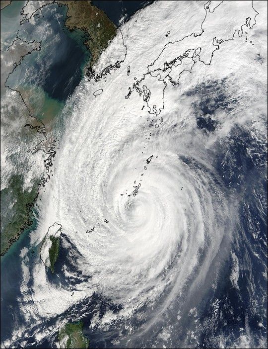
The MODIS instrument onboard NASA's Terra satellite captured this true-color image of Typhoon Tokage on October 19, 2004 at 2:15 UTC. At the time this image was taken, Tokage was located approximately 98 miles south-southest of Okinawa, Japan and had maximum sustained winds near 86 mph.

The MODIS Rapid Response System provides this image at additional resolutions and formats.

References & Resources

NASA image courtesy Jacques Descloitres, MODIS Land Rapid Response Team at NASA GSFC.

You may also be interested in:

Stay up-to-date with the latest content from NASA as we explore the universe and discover more about our home planet.

Fires Erupt in South-Central Chile 
2 min read

Tens of thousands of people fled to safety as blazes spread throughout the country’s Biobío and Ñuble regions.

Article
Ragasa Steers Toward China
3 min read

The super typhoon headed for Guangdong province after lashing Taiwan and northern Luzon in the Philippines.

Article
Winter Grips Japan
3 min read

The country's northern regions are accustomed to snow, but unrelenting storms have snarled transportation and caused other challenges this winter.

Article